The land of canyons in southeastern Utah is one of the most stunning places in the USA. It boasts table mountains, stone arches, and at its heart, two magnificent canyons carved into the Colorado Plateau by the Colorado River and the Green River. Welcome to Canyonlands National Park.
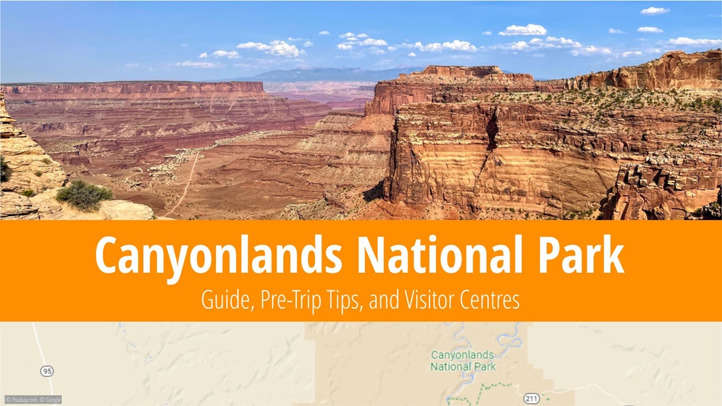
Table of Contents
- Information About Canyonlands National Park
- What to See and Do in Canyonlands National Park
- When to Visit Canyonlands National Park
- Entrance Fees for Canyonlands National Park
- Traveling to Canyonlands National Park
- Lodging at Canyonlands National Park
- Advice and Recommendations Before Traveling to Canyonlands National Park
- Photos of Canyonlands National Park
Information About Canyonlands National Park
The national park, spanning 527 sqmi, is nestled near the city of Moab, centrally located within a quadrangle formed by the national parks Grand Canyon, Capitol Reef, Arches and Mesa Verde. Perhaps the proximity of these parks influences visitation – 911,594 individuals experienced Canyonlands in person in 2021. It was designated a national park on September 12, 1964.
The park itself is split into three distinct areas: Island in the Sky to the north, The Maze to the southwest, and The Needles to the southeast. The highest point in the park is Cathedral Point at 7,119 ft above sea level, while the lowest point is a section of the Colorado River at 3,740 ft.
The wildlife of Canyonlands National Park mirrors its desert landscape. Residents include coyotes, skunks, foxes, red lynxes, porcupines, lizards, and snakes. Birds such as eagles and hawks dominate the skies. Among the plant life, cacti and other succulents, mosses, lichens and various shrubs are most common, their smaller growth owing to water scarcity and the necessity to conserve it.
The film 127 Hours, depicting the true story of Aron Ralston, was filmed in the national park. Ralston went rock climbing in Canyonlands in May 2013 when a loose boulder in Blue John Canyon trapped his hand, leaving him stuck for five days and seven hours. The escape was extreme. To free himself, he was forced to amputate his right hand. Notably, legendary outlaws Butch Cassidy and the Sundance Kid once took refuge in Canyonlands for a time.
What to See and Do in Canyonlands National Park
The most accessible part is Island in the Sky in the north; in contrast, the Maze area in the south is only accessible by 4×4 vehicles.
What to See in the Island in the Sky Area
- Grand View Point: An impressive view of the canyons. A visit at sunset is highly recommended.
- Green River Overlook: Another viewing point, this one offering views over the Green River, one of the two rivers that shaped Canyonlands NP into its current form.
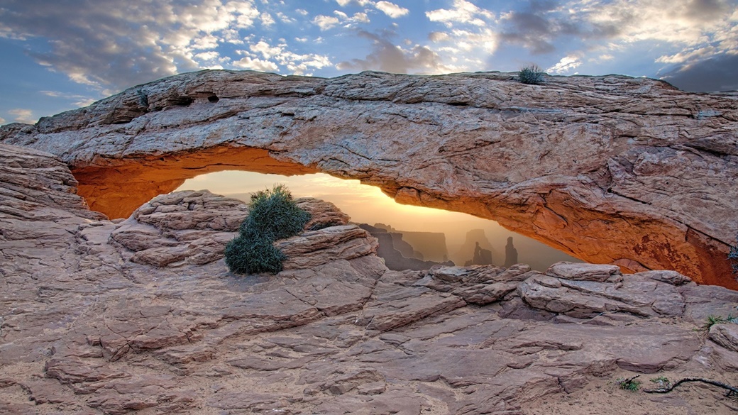
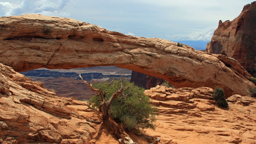
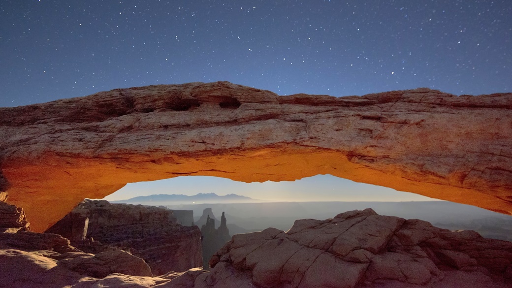
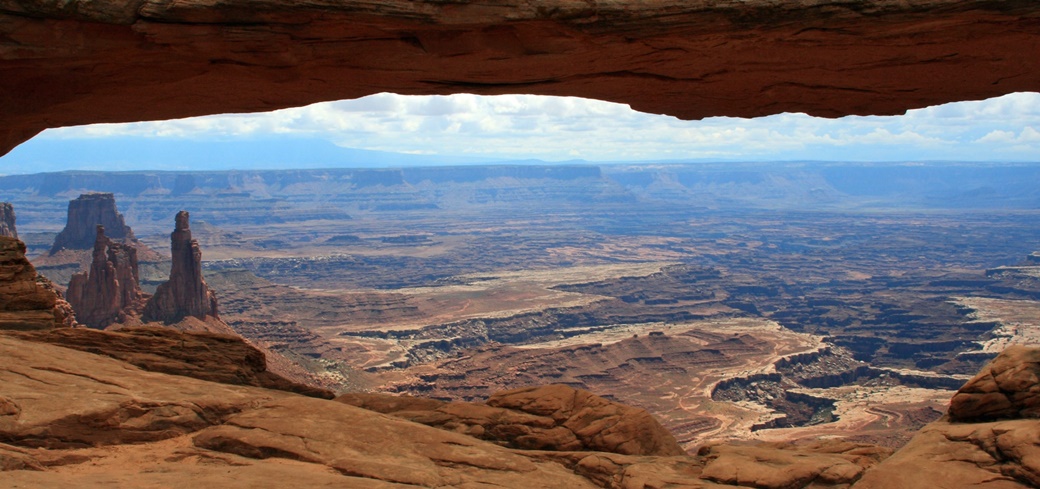
- Mesa Arch: A monumental stone arch, which is especially beautiful at sunset.
- Upheaval Dome: A crater no more than 170 million years old, accessible by a short but very demanding trail.
What to See in the Needles Area
- Big Spring Canyon Overlook: A view of the surrounding canyons, accessible by car.
- Confluence Overlook: A spot offering a beautiful view of the confluence of the Colorado River and Green River. It can be reached either on foot or by off-road vehicle.
- Tower Ruin: The remains of a structure once inhabited by the Pueblo Indian tribe.
- Chesler Park: An area situated in the heart of the Needles, scattered with numerous sandstone formations.
- Druid Arch: A stone arch, located at the end of a long canyon and accessible by foot.
What to See in the Maze Area
- Chocolate Drops: A cluster of table mountains of sandstone rising above the surrounding landscape.
- Horseshoe Canyon: Small cliffs – some of the most renowned in all of North America.
Hiking is as integral to visiting national parks as a well-chilled beer is to a sunny summer day. Canyonlands NP boasts an impressive network of 196 mi of trails of varying lengths and levels of difficulty.
Hiking Trails in the Island in the Sky Area
Maps can be downloaded from the park’s website.
- Mesa Arch Trail
This easy 2,625 ft trail can be completed in about 30 minutes. We recommend coming early in the morning, as it is a popular spot for photographing sunrises. - Grand View Point Trail
This easy, 2 mi trail along the canyon rim offers spectacular views of the surrounding area. - Murphy Point Trail
Just under 4 mi long, this trail passes through a historic corral and ends with an impressive overlook. - Upheaval Dome Trail
This slightly more challenging, 1 mi trail offers views of a fascinating rock formation. - Whale Rock Trail
The 1 mi trail can be completed in approximately an hour and offers good views of Upheaval Dome and the surrounding area. - Aztec Butte Trail
This 2 mi trail takes you to an ancient Indian granary and a viewpoint overlooking Taylor Canyon. - Neck Spring Trail
A 6 mi loop featuring diverse wildlife and a couple of springs. - Gooseberry Canyon Trail
Although only 1,401 ft long, this trail is very challenging. It extends from the White Rim Overlook to the canyon floor. - Syncline Loop Trail
A challenging, 8 mi loop that goes around the Upheaval Dome Crater. - Murphy Loop Trail
Over 11 mi of advanced trail takes you to the bottom of the canyon and then along the White Rim Road, before turning back to follow a path of large boulders. - Wilhite Canyon Trail
Nearly 12 mi of trail, mostly over boulders. - Taylor Canyon Trail
A highly challenging 20 mi trail that runs from the top of Table Mountain to the Green River and back. - Lathrop Canyon Trail
An extremely challenging trail that runs from the top of Table Mountain to the Colorado River and back.
Hiking Trails in the Needles
Maps can be downloaded from the park’s website.
- Roadside Ruin Trail
This easy 1,640 ft trail takes you to a grain granary that was once used by the Pueblo Indians. - Pothole Point Trail
The 1 mi trail offers a diverse ecosystem and views of the Needles section. - Cave Springs Trail
The 1 mi trail passes through an old cowboy campground, with two ladders to climb along the way and historic petroglyphs to view. - Slickrock Trail
A 2 mi trail with several overlooks where hikers are often greeted by bighorn sheep. - From Big Spring to Squaw Canyon
The slightly more challenging 7 mi trail will provide those interested with a good impression of the landscape in the Needles. It’s not recommended for those with a fear of heights. - From Squaw Canyon to Lost Canyon
The 9 mi route is similar to the previous one but delves deeper into the canyon. - Confluence Overlook Trail
The 10 mi trail leads to the confluence of the Green River and Colorado River. - Peekaboo Trail
A challenging trail with views that make the effort worthwhile! - Chesler Park/Joint Trail
The 11 mi trail offers views of desert grasses and colorful sandstone spires. - Elephant Canyon / Druid Arch
A strenuous 11 mi trail leads to the bottom of the canyon. Be prepared to climb a ladder. - Lower Red Lake Canyon Trail
This highly strenuous 19 mi trail is suitable for a multi-day hike. - Salt Creek Canyon Trail
The most challenging trail in this part of the park is 21 mi long. Beginning at Cathedral Butte, it passes through a drainage channel, dense undergrowth, and rich archaeological sites.
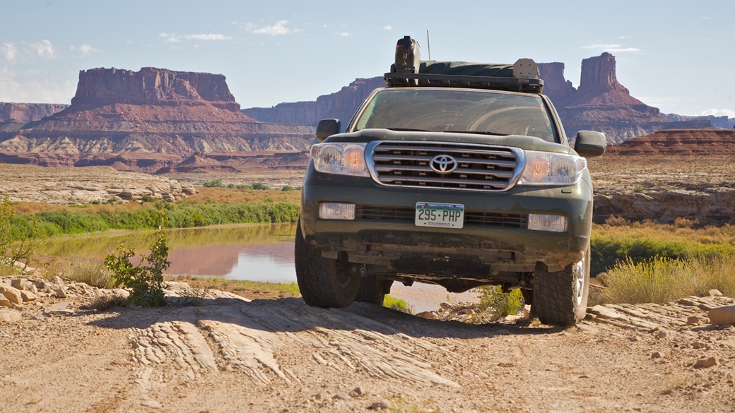
Driving around the park in 4×4 vehicles is also popular. Most drivers choose the challenging, 99 mi route along the White Rim Road circular road. The same route can also be ridden on a mountain bike. A ranger permit is required for multi-day trips.
Paddlers will also find enjoyment in Canyonlands National Park. Both the Green and Colorado Rivers are navigable by kayak or canoe.
When to Visit Canyonlands National Park
Canyonlands National Park is open year-round, with most visitors arriving in the spring (April to May) and fall (mid-September to October). During these times, daytime temperatures typically range from 39 °F to 68 °F.
Summer is not an ideal time to visit due to high temperatures often reaching 104 °F. Toward the end of summer, heavy rains frequently strike the landscape and can cause flash floods.
Winters, on the other hand, are very cold, with temperatures seldom rising above freezing on the vast majority of days. Snow showers are rare, except in the nearby mountains, but even a light dusting of snow results in impassable roads.
Average Temperatures and Visitor Numbers in Canyonlands National Park
The average temperatures in Canyonlands National Park are based on a 2017-2021 average. The data source is the National Park Service.
| Max Temp | Min Temp | Precipitation Days | Visitors | Popularity | |
|---|---|---|---|---|---|
| January | 39 °F | 21 °F | 2.8 | 9 608 | 🟩 |
| February | 48 °F | 28 °F | 2.9 | 15 450 | 🟩 |
| March | 61 °F | 36 °F | 3.5 | 65 484 | 🟨🟨 |
| April | 68 °F | 43 °F | 3.4 | 94 952 | 🟧🟧🟧 |
| May | 79 °F | 52 °F | 3.2 | 118 460 | 🟥🟥🟥🟥 |
| June | 90 °F | 63 °F | 1.9 | 97 487 | 🟧🟧🟧 |
| July | 95 °F | 68 °F | 4.6 | 73 550 | 🟨🟨 |
| August | 91 °F | 66 °F | 5.1 | 72 242 | 🟨🟨 |
| September | 82 °F | 57 °F | 5.1 | 96 148 | 🟧🟧🟧 |
| October | 68 °F | 45 °F | 4.0 | 86 059 | 🟧🟧🟧 |
| November | 54 °F | 32 °F | 3.0 | 35 992 | 🟩 |
| December | 41 °F | 23 °F | 2.8 | 15 273 | 🟩 |
Entrance Fees for Canyonlands National Park
The entrance fee for Canyonlands National Park for a passenger car and all its occupants is $30. The fee for motorcycle entry is $25, and for pedestrians, it is $15.00 per person. In all cases, the tickets are valid for one week.
Admission to Canyonlands is free on national holidays and always on August 25, the anniversary of the National Park Service, also known as the Park Service.
If you plan to visit multiple national parks or monuments in the USA over 12 months, consider the America the Beautiful pass. The pass costs $80 and is comparable to a football season ticket—you pay once and then can visit the parks as much as you want.
Traveling to Canyonlands National Park
A primary requirement for visiting Canyonlands Park is a rental car, preferably with 4×4 drive, as sightseeing without one can be difficult. To simplify the journey, here are the distances and commute times from several nearby locations:
| Location | Distance | Drive Time | Route |
|---|---|---|---|
| Denver | 364 mi | 5 hours 45 minutes | View Route |
| Las Vegas | 468 mi | 6 hours 45 minutes | View Route |
| Arches National Park | 29 mi | 40 minutes | View Route |
| Capitol Reef National Park | 155 mi | 2 hours 45 minutes | View Route |
| Grand Canyon National Park | 298 mi | 4 hours 50 minutes | View Route |
| Mesa Verde National Park | 157 mi | 2 hours 50 minutes | View Route |
| Salt Lake City | 244 mi | 4 hours | View Route |
| San Francisco | 977 mi | 14 hours 45 minutes | View Route |
Parking is available at the visitor centers, and you can also stop along individual trails as you traverse the park.
Lodging at Canyonlands National Park
🏨 Hotels
There are no hotels or motels directly in Canyonlands. However, you can find accommodation in the nearby towns of Moab, located north of the park, and Monticello, located southeast of the park. Both towns are situated on Highway 191 and have several hotels:
⛺ Campsites
Inside the park, there are two campsites suitable for camping and overnight caravanning:
- Squaw Flat Campground
Located in the Needles section, the campground serves as an excellent starting point for hiking in Chesler Park, to Druid Arch, and along the Joint Trail. The fee is $20.00 per campsite per night. The campground operates on a first-come, first-served basis, and please note that it is often full during peak season. The campground can accommodate up to 10 people. - Willow Flat Campground
This 12-site campground is located in the Island in the Sky area and also operates on a first-come, first-served basis. The fee is $15.00 per spot per night, and reservations are not possible.
Advice and Recommendations Before Traveling to Canyonlands National Park
ℹ️ Visitor Center
It is recommended to begin your tour of the park by visiting one of the visitor centers:
- Island in the Sky Visitor Center
Located in the north of the park (Show on Map), the main information center is open daily from 9:00 am to 4:00 pm from spring through fall, and even longer in the summer. It is closed on public holidays. Here you can see exhibits featuring Canyonlands Park, get additional information, and purchase souvenirs. - Needles Visitor Center
This visitor center (Show on Map) serves those who enter the park from the south. Offering services similar to the Island in the Sky Visitor Center, it is open from March through Thanksgiving daily from 8:30 a.m. to 4 p.m. - Hans Flat Ranger Station
The ranger station (Show on Map) is open daily, except on national holidays, from 8 a.m. to 4:30 p.m.
👍 Good to Know
Allocate at least 6 hours for your visit to Canyonlands National Park. Make sure to pack plenty of water and food (jerky is recommended), as these are not available in the park. Do not forget to bring headgear and sunscreen during the summer months, and an extra layer of clothing in the spring and fall for when temperatures drop.
Finally, it is advisable to download maps of the park in .pdf format to your phone. These maps indicate the campsites, trails, and all points of interest.
Photos of Canyonlands National Park
US National Parks
- National Parks of the USA – Map, List and Annual Pass
- America the Beautiful Pass 2025 – How It Works, Cost & Parks
- Timed-Entry Reservation for US National Parks (2025 GUIDE)
Travel Guides to USA National Parks

 10 Best Photo Places in the USA


Contribute with Your Question or Personal Experience