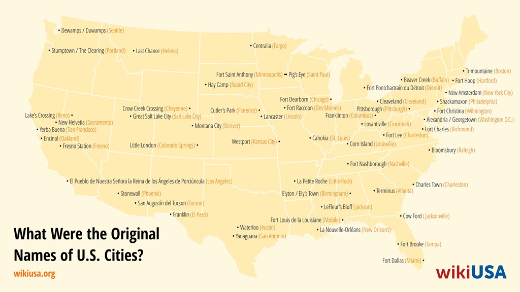
Before 1847, San Francisco was known as Yerba Buena, and prior to 1781, Los Angeles bore the lengthy name “El Pueblo de Nuestra Señora la Reina de los Ángeles del Río Porciúncula.” The origins of U.S. city names are tied to intriguing stories. The name Buffalo came about due to a translator mistaking the names of animals. Cleveland got its name when a local newspaper shortened the original version to fit on the page. As for Portland, its name was decided by three coin tosses.
Table of Contents
- How American City Names Came to Be
- Historical Names of American Cities
- Atlanta — Terminus
- Austin — Waterloo
- Birmingham — Elyton / Ely’s Town
- Boston — Trimountaine
- Buffalo — Beaver Creek
- Cincinnati — Losantiville
- Cleveland — Cleaveland
- Colorado Springs — Little London
- Columbus — Franklinton
- Denver — Montana City
- Des Moines — Fort Raccoon
- Detroit — Fort Pontchartrain du Détroit
- El Paso — Franklin
- Fargo — Centralia
- Florence — Cutler’s Park
- Fresno — Fresno Station
- Hartford — Fort Hoop
- Helena — Last Chance
- Charleston, SC — Charles Town
- Charleston, WV — Fort Lee
- Cheyenne — Crow Creek Crossing
- Chicago — Fort Dearborn
- Jackson, MS — LeFleur’s Bluff
- Jacksonville — Cow Ford
- Kansas City — Westport
- Lincoln — Lancaster
- Little Rock — La Petite Roche
- Los Angeles — Porciúncula
- Louisville, Kentucky — Corn Island
- Miami — Fort Dallas
- Minneapolis — Fort Saint Anthony
- Mobile — Fort Louis de la Louisiane
- Nashville — Fort Nashborough
- New Orleans — La Nouvelle-Orléans
- New York — New Amsterdam
- Oakland — Encinal
- Philadelphia — Shackamaxon
- Phoenix — Stonewall
- Pittsburgh — Pittsborough
- Portland — Stumptown / The Clearing
- Raleigh — Bloomsbury
- Rapid City — Hay Camp
- Reno — Lake’s Crossing
- Richmond — Fort Charles
- Sacramento — New Helvetia
- Saint Paul — Pig’s Eye
- Salt Lake City — Great Salt Lake City
- San Antonio — Yanaguana
- San Francisco — Yerba Buena
- Seattle — Dewamps / Duwamps
- St. Louis — Cahokia
- Tampa — Fort Brooke
- Tucson — San Augustín del Tucson
- Washington D.C. — Alexandria / Georgetown
- Wilmington — Fort Christina
How American City Names Came to Be
Did you know that Native Americans and the railroad have a shared history in the creation of many towns?
In the 18th and 19th centuries, much of the land that now makes up the United States was under Spanish, French, and British control, with around 560 Native American tribes living across the region. Frequent conflicts, known as the Indian Wars, broke out between European colonizers and Native tribes. Colonizers often displaced Native communities from their lands, while Native groups launched raids on settlements.
Colonial armies built forts that housed soldiers as well as civilians. Over time, these forts expanded and, during peaceful periods, transformed into typical towns. Then came the 1860s.
One gold rush followed another, and on May 10, 1869, the first transcontinental railroad was completed, stretching from Omaha to the San Francisco Bay Area. Railway stops were established near prosperous farms, prominent settlements, and mines with substantial economic potential.
These locations attracted new residents, and populations grew rapidly, eventually leading to the establishment of new towns. The railroad company often had the final say on the town’s name.
Historical Names of American Cities
-
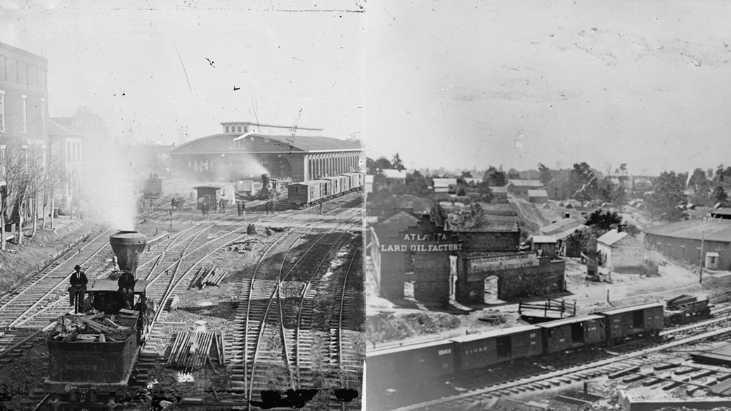
← Atlanta train station in 1864, photographed by George N. Barnard (1819–1902).
→ Atlanta during the American Civil War, sometime between 1861 and 1865, by an unknown author.Atlanta — Terminus
Atlanta owes its origins to the railroad. After 1836, construction began on a railway connecting Georgia’s oldest city, Savannah, to the Midwest.
During the initial phase of construction, the track started in Chattanooga and ended near the Chattahoochee River, where it would later connect to the line leading to Savannah.
About a year after completion, the first residents settled at the end of the line. The location was named Terminus, meaning “final station.” By 1842, the settlement had only 30 inhabitants, but the population grew rapidly. On December 29, 1847, the citizens approved a name change proposed by a conductor from the Georgia Railroad and Banking Company. The initial suggestion, Atlantica-Pacifica, was deemed too long and failed to pass a vote, but the shorter name, Atlanta, was accepted.
-
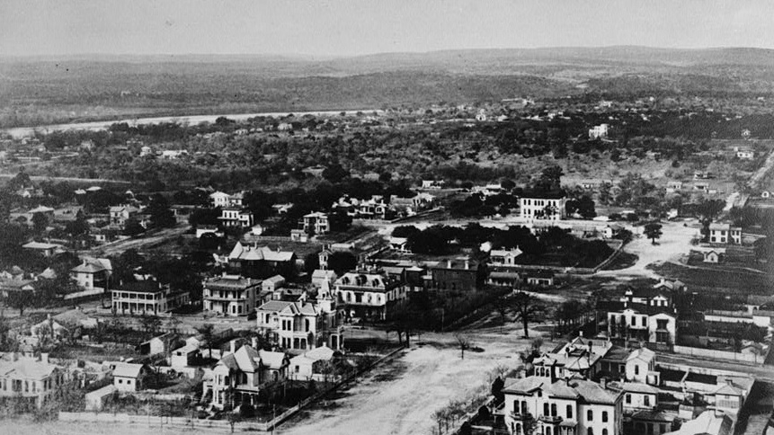
View from the Texas Capitol overlooking west Austin. The photo was taken by Charles B. Wheelock sometime between 1887 and 1894.
Austin — Waterloo
The earliest recorded mention of Austin dates back to the 1830s when a group of Anglo-American settlers arrived in Texas. In 1837, they established the settlement of Waterloo on the banks of the Colorado River.
In 1839, the Texas Congress elevated Waterloo to city status and soon renamed it Austin in honor of Stephen F. Austin, who had negotiated a treaty with local Native American tribes to establish territorial boundaries.
After years of political deliberation, Austin was officially declared the capital of Texas on February 19, 1846. At the time, the city’s population only numbered in the hundreds, and it wasn’t until shortly before 1880 that Austin surpassed 10,000 residents.
-
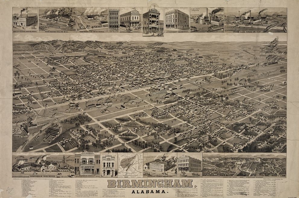
Birmingham, Alabama, around 1885. The photo was created by Wellge Norris & Co.
Birmingham — Elyton / Ely’s Town
In 2024, Birmingham is Alabama’s second-largest city, with a population of 195,400. Its history dates back to December 20, 1820, when the town of Elyton was founded at what is now the intersection of Cotton Avenue and 7th Street Southwest. The establishment of the town was made possible by a grant of 160 acres of land from the federal government, which was negotiated by land agent William Ely from Connecticut, after whom the town was named.
Between 1821 and 1871, Elyton served as the county seat of Jefferson County. In 1911, the rapidly expanding Birmingham absorbed Elyton, benefiting from low commercial real estate prices.
-
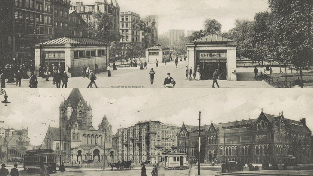
↑ Entrance to the subway on Boston’s Park Street around 1905, photographed by the Rotograph Company of New York.
↓ Copley Square in Boston around the same time, also photographed by the Rotograph Company.Boston — Trimountaine
The first European settlers arrived in what is now the state of Massachusetts around 1630. They established a settlement called Trimountaine, a reference to the three hills in the area. However, the name was quickly changed to Boston after the English city of the same name, which was the hometown of several of the settlers.
In 1635, Boston established the first public school in America. Over the next few centuries, the city played a role in the French and Indian Wars, as well as the transatlantic slave trade.
Boston’s size tripled over the next 250 years. In 1722, it had a population of 10,567, which grew to 43,298 by 1820 and 748,060 by 1920.
-
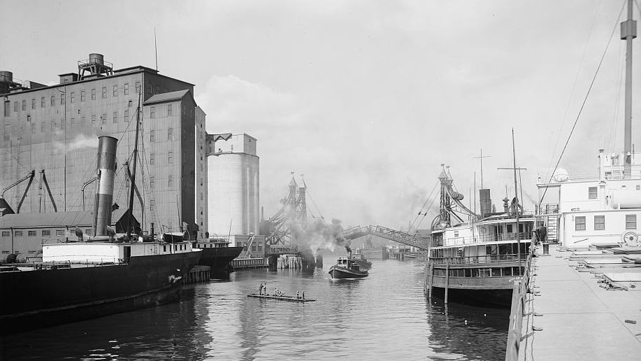
The Buffalo River between 1900 and 1915, first published by Detroit Publishing Co.
Buffalo — Beaver Creek
Buffalo is located in the state of New York, close to the Niagara Falls. The first records of settlement date back to 1789 when former slave Joseph “Black Joe” Hodge and trader Cornelius Winney built a wooden hut to facilitate trade with local Native Americans. The area was known as Beaver Creek due to its abundant beaver population.
Beaver pelts were the most sought-after commodity on the market, leading to a theory about the city’s name: it is said that a translator mistakenly interpreted the native word for beaver as “buffalo.” In the early 19th century, the Dutch purchased the land, and in 1801, a new settlement was established. Buffalo was officially recognized as a city in 1832, with a population of about ten thousand.
-
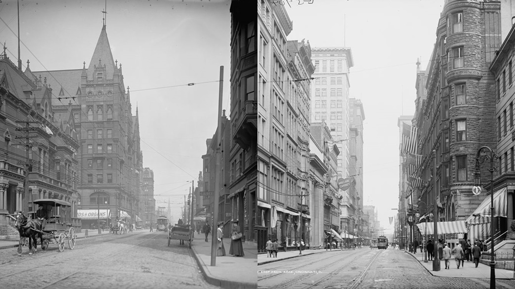
← Elm Street in Cincinnati between 1900 and 1910.
→ Fourth Street in Cincinnati during the same period. Photo rights belong to Detroit Publishing Co.Cincinnati — Losantiville
The city of Cincinnati in Ohio was founded in 1788 by the descendants of European immigrants. One of the founders, John Filson, named it Losantiville, combining the Latin word “os” (mouth), the Greek “anti” (opposite), and the French “ville” (city). Losantiville was located on the opposite side of the Licking River’s mouth.
In 1790, Arthur St. Clair, governor of the Northwest Territory, renamed the settlement Cincinnati in honor of the Society of the Cincinnati, a group of war veterans of which he was a member.
-
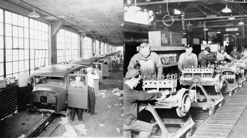
An assembly line at the Chandler Motors Corporation plant on 300 East 131st Street. Today, only a fragment of the building remains. Photos were taken in the early 20th century by Cleveland Press.
Cleveland — Cleaveland
The history of the city began on July 22, 1796, when explorers from the Connecticut Land Company founded several towns in the Western Reserve (now Ohio). The main settlement was named Cleaveland after their leader, Moses Cleaveland. The city was officially registered on December 23, 1814.
The first resident of Cleaveland was Lorenzo Carter, who built a cabin on the banks of the Cuyahoga River.
The name was changed to Cleveland in 1831 in an unusual manner. According to legend, the local newspaper, The Cleveland Advertiser, dropped a letter from the name to fit the city’s name into a newspaper column. The paper ceased publication in 1837, but Cleveland has endured. According to some opinions, this theory may not be entirely accurate.
-
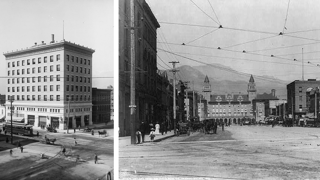
← Colorado Springs sometime between 1900 and 1910. The photograph is attributed to Detroit Publishing Co.
→ The Antler’s Hotel and Pike’s Peak Avenue around 1908.Colorado Springs — Little London
The area of modern-day Colorado Springs was originally inhabited by the Ute, Arapaho, and Cheyenne tribes. They lost part of their land in 1803 when it was purchased from the French by the United States.
The first permanent residents appeared in Colorado Springs around the mid-19th century, with significant growth spurred by the Pikes Peak Gold Rush.
Colorado Springs was named after three mineral springs in the area, although settlers and tourists from England commonly referred to it by its unofficial nickname, Little London. The name was championed by financier William Abraham Bell, who provided funding for the construction of the railway into Colorado Springs.
-
The Ohio State Capitol building in Columbus around 1860.
Columbus — Franklinton
Columbus is the capital and, with 850,000 residents, the largest city in Ohio. The city’s history began in the 18th century when the region was under French control and dominated by the fur trade.
The fur trade led to frequent conflicts, which continued even after the American Revolution. Peace and settlement opportunities arrived in 1795 with the Treaty of Greenville.
In 1797, a young surveyor named Lucas Sullivant established a settlement on the west bank of the confluence of the Scioto River and the Olentangy River. An admirer of President Benjamin Franklin, Sullivant named the new settlement Franklinton. However, the village was washed away by a flood two years later.
The village was rebuilt within a few years, and on February 14, 1812, a new city was established nearby, named Columbus after the explorer Christopher Columbus. The population grew rapidly, and by 1837, Columbus had absorbed the declining Franklinton.
-
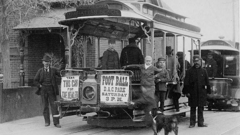
A streetcar in Denver, circa 1895.
Denver — Montana City
During the summer of 1858, the Pikes Peak Gold Rush in the Rocky Mountains was at its peak. A group of gold prospectors from Kansas established a mining town on the banks of the South Platte River and named it Montana City. However, the settlement was short-lived, as most of its residents moved to nearby Auraria and St. Charles City within a year.
Around the same time, land speculator and future senator William Larimer Jr. established the city of Denver near the former Montana City and close to the Auraria and St. Charles City settlements.
Larimer strategically named the city after James W. Denver, then governor of Kansas Territory, hoping that it would become the county seat of Arapahoe County. His plan failed, as Governor Denver had already resigned from office.
-
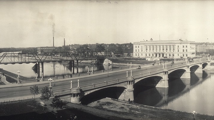
The city of Des Moines, Iowa, around 1914.
Des Moines — Fort Raccoon
The history of Iowa’s most populous city, Iowa, dates back to May 1843 when Captain James Allen oversaw the construction of a fort at the confluence of the Des Moines and Raccoon rivers. The fort was meant to mark the territory of the Sauk and Meskwaki Native American tribes, who had been relocated to the area by the government.
Although Captain Allen preferred the name Fort Raccoon, the U.S. War Department favored Fort Des Moines. The fort turned out to be a failure, plagued by illegal whiskey trading, and by 1846, the Native Americans were relocated once again. The town of Fort Des Moines was established on September 22, 1851, at the site of the fort, and its name was shortened to Des Moines in 1857.
-
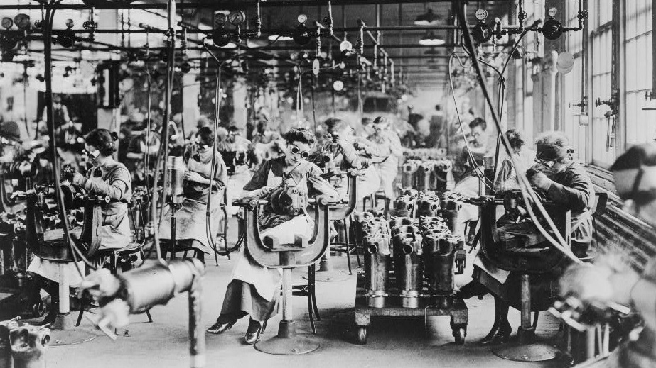
Detroit was always driven by industry. This photo, taken between 1914 and 1918, shows female workers at the welding shop of the Lincoln Motor Company.
Detroit — Fort Pontchartrain du Détroit
In 1701, officer Antoine de la Mothe Cadillac, along with 51 other Frenchmen, established the settlement of Fort Pontchartrain du Détroit. The name came from the Detroit River and Louis Phélypeaux, Count of Pontchartrain and Minister of the Navy during the reign of Louis XIV.
Cadillac acquired the land for free from the French government, which aimed to attract settlers to the region of present-day Michigan. The strategy worked. While Detroit had only 800 residents in 1765, by 1778, the population had grown to 2,144. At that time, Detroit was the third-largest city in the province of Quebec.
The region’s prosperity was driven by the lucrative fur trade. In 1760, the British took control of the city and shortened its name to Detroit. The United States gained Detroit through Jay’s Treaty of 1794, which also established the current U.S.-Canada border.
-
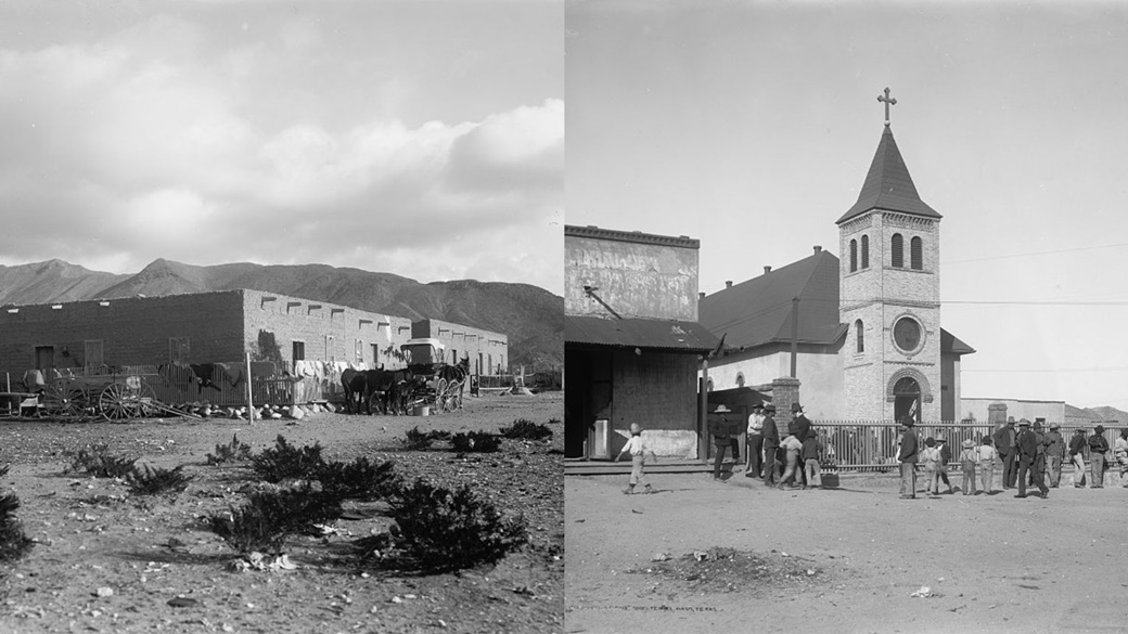
← Adobe house in El Paso with Mount Franklin in the background.
→ Mexican church in El Paso. Both photos were published around 1907 by the Detroit Publishing Co.El Paso — Franklin
El Paso, Texas, was established in 1680 as a temporary base for the Spanish administration in the New Mexico territory. It became part of Texas in 1848 when the United States took control of the area.
The following year, the U.S. established the Fort Bliss military base in the region. Around the same time, the settlement of Franklin began to grow further west, forming the heart of present-day El Paso.
El Paso was officially incorporated in 1873, with its population at the time consisting of 87% Hispanic residents.
-
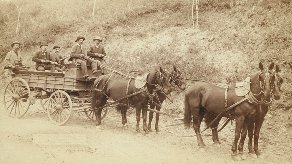
Armed employees of Wells Fargo Express Co. transporting gold nuggets worth $250,000 from the Great Homestake Mine. The photo was taken in 1890 by John Grabill.
Fargo — Centralia
Fargo is known as a movie, a TV series, and most importantly, the most populous city in North Dakota. It was founded in 1871 as a stop for steamships traveling along the Red River. At the time, it was named Centralia due to its strategic location.
The city’s growth was significantly boosted by the construction of the Northern Pacific Railway, spearheaded by its director and the founder of Wells Fargo Bank, William Fargo. In his honor, the city was renamed Fargo on February 14, 1872.
-
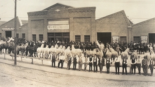
A horse market in Nebraska around 1914, attributed to Bee Publishing Co.
Florence — Cutler’s Park
In August 1846, members of The Church of Jesus Christ of Latter-day Saints settled near the confluence of the Missouri and Platte Rivers during their journey to the Rocky Mountains. About 2,500 Mormons temporarily lived in Nebraska but left the settlement by December of the same year. They left behind a memorial and several buildings.
In 1854, settler James C. Mitchell led efforts to repopulate the area, restoring the original buildings and naming the settlement Florence after his niece, Florence Kilbourn. Today, Florence is a neighborhood of Omaha, which had a population of 483,335 in 2023.
-
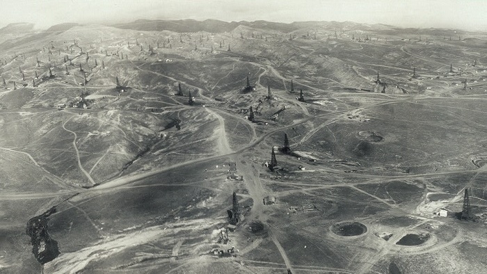
In the early 20th century, California was one of the world’s largest oil producers. This photo, taken in 1910 by a photographer from R. J. Waters Aerial Photograph Co., shows oil derricks near the city of Fresno.
Fresno — Fresno Station
Fresno was founded in 1872 by the Southern Pacific Railroad company, which was building a rail line from New Orleans to Los Angeles. The company established a station near a successful wheat-producing farm and named it Fresno Station.
A store soon opened near the station, and a new town began to take shape. Many of the settlers came from Millerton, a village frequently affected by floods from the nearby San Joaquin River.
Fresno officially became a city in 1885, during a period of rapid population growth. To illustrate this, the city’s population was 1,112 in 1880, but by 1890, it had surged to 10,818.
-
Hartford — Fort Hoop
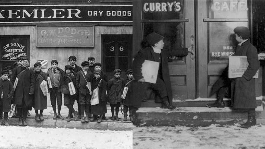
← At the start of the 20th century, young boys earned money by selling newspapers. They often worked from 5 or 6 a.m…
→ …and finished their shift around 9:30 p.m. The best customers were reportedly drunk patrons from saloons. Both photos were taken in Hartford in March 1909 by Lewis Wickes Hine.Europeans first arrived in Connecticut in 1614 as part of an expedition led by Dutch trader Adriaen Block. They returned to America 19 years later to establish a branch of the Dutch West India Company.
On the southern bank of the Park River, they built Fort Hoop, home to Dutch soldiers among others. The city of Hartford was established by the English north of the fort after 1637 and was named after the English town of Hertford.
The Industrial Revolution in the 19th century brought significant prosperity to Hartford, making it one of the wealthiest cities in the United States. Today, Hartford has about 125,000 residents and is home to the prestigious Trinity College.
-
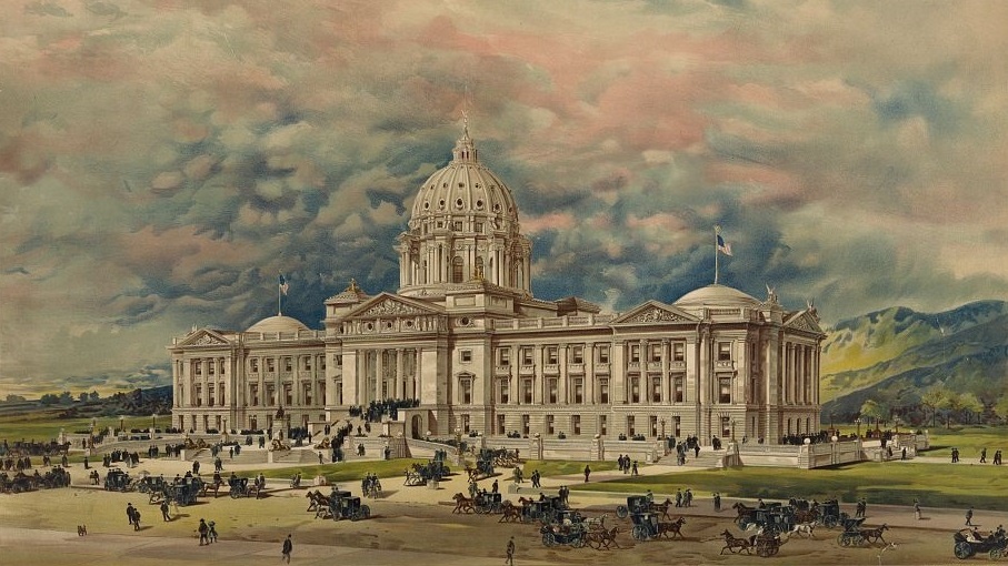
The winning design for Montana’s capitol building, created by architect George Richard Mann in 1896, was never built. The design competition was canceled after it was discovered that the judging committee intended to engage in fraud.
Helena — Last Chance
Helena is a city in Montana, built on the foundations of the Last Chance mining camp established during the Gold Rush around 1864. The original name did not last long. Later that year, a seven-member self-appointed committee convened to rename it. They initially considered the Native American name Tomah.
Since the meeting took place a day before Halloween, humorous names like Pumpkinville and Squashtown were suggested. The name Helena, referencing a town in Minnesota, was proposed by Scottish-born John Summerville.
-
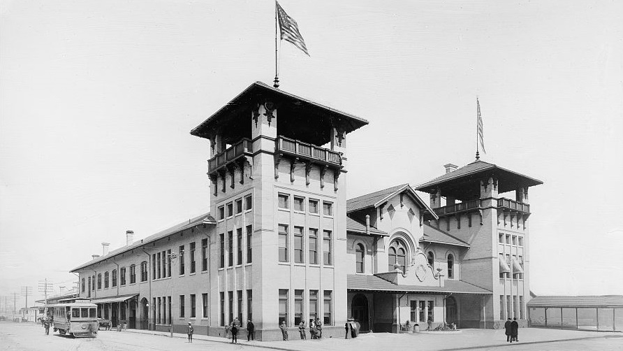
Union Station in Charleston, South Carolina, sometime between 1910 and 1920. The photo is part of the Detroit Publishing Co. archive.
Charleston, SC — Charles Town
The history of Charleston, located in South Carolina, began on March 24, 1663, when King Charles II of England granted the Province of Carolina to eight loyal friends. It took seven years for the first settlers to arrive from Bermuda.
They founded a town on the west bank of the Ashley River and named it Charles Town in honor of the king. At the time, Charles Town was one of the earliest English settlements in America, featuring its own government and urban development plans. After the American Revolutionary War ended in 1783, the town’s name was slightly modified to Charleston.
In the early 18th century, Charleston became a major hub for the trade of deerskins. Between 1739 and 1761, approximately 2,376 tons of deerskins were exported from the city, which roughly translates to 0.5 to 1.25 million hides.
-
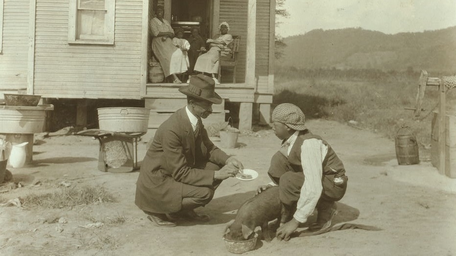
George Cox, a 13-year-old African American boy from a poor background, was able to attend an agricultural school thanks to the 4-H Club charity. The man in the foreground is his teacher. The photo was taken on October 10, 1921, by Lewis Wickes Hine.
Charleston, WV — Fort Lee
Colonel and land speculator George Clendenin purchased 2 sqmi of land near the mouth of the Elk River in 1786. The following year, he began building the fortified settlement of Fort Lee with the help of his company, the Virginia Rangers. He named the fort after his father, Charles Clendenin, a prominent officer during the American Revolutionary War.
Fort Lee provided protection to white settlers against Native American raids. Over time, the settlement grew into a town named Charles Town, in honor of Clendenin’s father. However, the name was later shortened to Charleston to avoid confusion with another Charles Town located in eastern West Virginia.
In the early 19th century, Charleston’s development accelerated thanks to the discovery of large salt deposits. By 1808, it was estimated that 1,250 lb of salt were produced daily in the region. At that time, the idea of having a railroad to transport the salt was merely a dream.
-
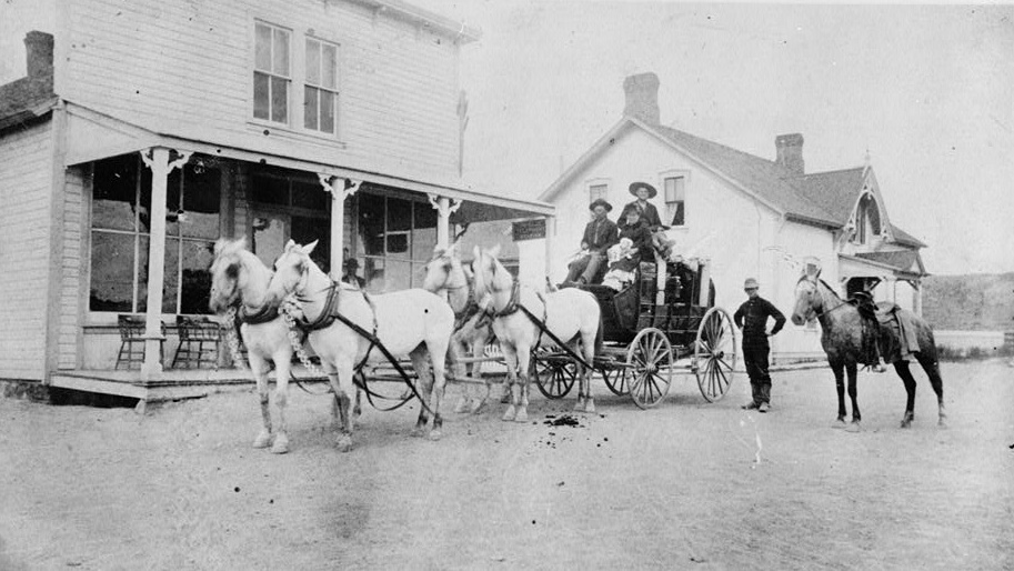
A hotel in the town of Chugwater, north of Cheyenne. The photo was taken in the early 20th century.
Cheyenne — Crow Creek Crossing
Cheyenne, a city with around 60,000 residents in the state of Wyoming, was founded on July 5, 1867, during the construction of the Union Pacific Railroad. General Grenville M. Dodge designated this area as a critical intersection between the railway and Crow Creek, a tributary of the South Platte River.
At that time, the railroad brought prospects of prosperity to remote areas. The temporary name Crow Creek Crossing was changed after the first train arrived on November 13, 1867. The city was named Cheyenne in honor of the Native American tribe. Within 20 years, its population had grown from about 1,450 to 11,690 residents.
-
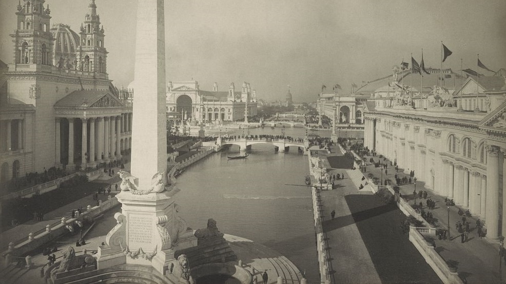
The World’s Columbian Exposition in Chicago, held in 1893, marked the 400th anniversary of the discovery of America. The photo was taken by Frances Benjamin Johnston.
Chicago — Fort Dearborn
The name Chicago is a French adaptation of the Native American word “shikaakwa,” meaning wild garlic. The first recorded settlement in the area dates back to the 1790s, after the conclusion of the Northwest Indian War, when the land was handed over to the U.S. Army by the local tribes.
Fort Dearborn was built on this site. Although it was destroyed during the Battle of Fort Dearborn in 1812, the army later rebuilt it in a nearby location.
By 1833, about 200 people lived in the area. On Saturday, March 4, 1837, the city of Chicago was officially incorporated. Its strategic location made it an important transportation hub, and for decades, it was one of the fastest-growing cities in the United States. By 1900, its population had reached 1.7 million, with a significant portion being of Czech descent.
-
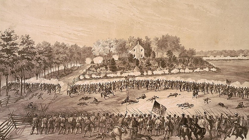
The Battle of Jackson, Mississippi, around 1863. The drawing was created by Alfred Edward Mathews of the 31st Ohio Volunteer Infantry Regiment.
Jackson, MS — LeFleur’s Bluff
Jackson was founded in 1821 after the general assembly of Mississippi determined that the state needed a centrally located capital. The original capital, Natchez, did not meet this requirement as it was situated near the border with Louisiana.
Finding a suitable location for the new city proved challenging due to the swamps in central Mississippi. Ultimately, the chosen site was land belonging to the Choctaw Nation. A small settlement named LeFleur’s Bluff, founded by Canadian-French trader Louis LeFleur, had already been established on the banks of the Pearl River.
The name Jackson was chosen to honor General Andrew Jackson and his victory at the Battle of New Orleans in January 1815. In 1829, Jackson became the 7th president of the United States. The city of Jackson developed significantly following the construction of the railroad and improvements to infrastructure. By 1850, its population had reached 1,881, surpassing 10,000 by the early 20th century.
-
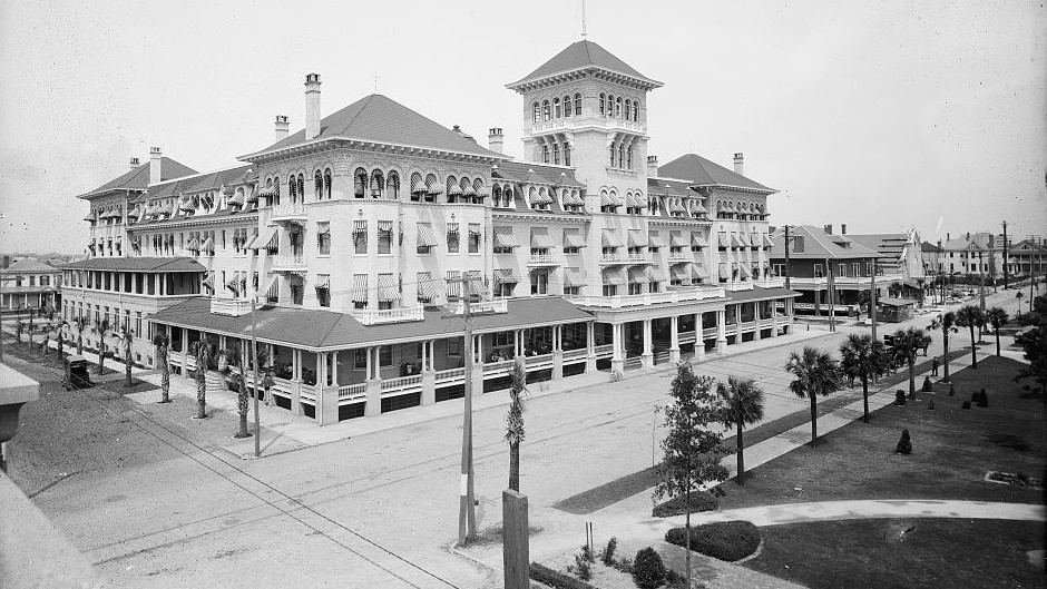
The Windsor Hotel in Jacksonville, Florida, between 1900 and 1910. The photograph was taken by the Detroit Publishing Co.
Jacksonville — Cow Ford
The area around Jacksonville was first settled by Europeans in 1564, when French colonizer René Goulaine de Laudonnière began building Fort Caroline. Just a year later, the fort fell to Spanish forces and was renamed San Mateo.
In 1763, the Spanish handed control of Florida to the British, who constructed a road connecting St. Augustine on the Atlantic coast to Georgia. They named the area Cow Ford and maintained control until 1783, after which the Spanish regained it for 38 years.
Jacksonville began to take shape in 1791, but significant development did not occur until Florida was acquired by the United States 30 years later. The city was named after President Andrew Jackson and officially incorporated on February 9, 1832.
-
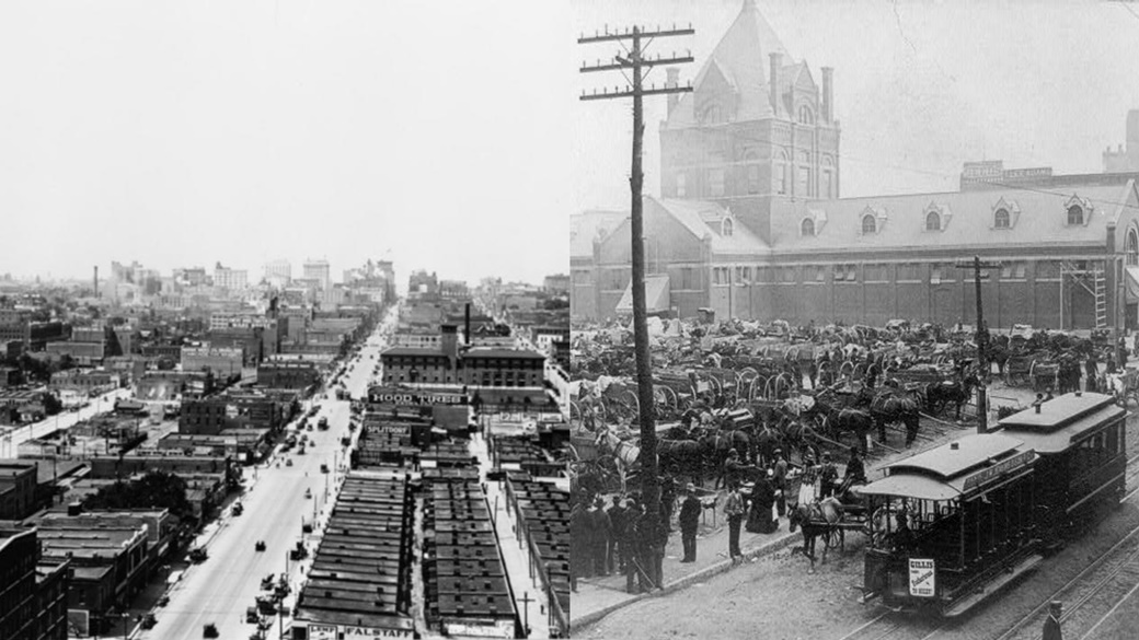
← The Kansas City business district, around 1915.
→ The Great Market in Kansas City, circa 1890.Kansas City — Westport
The settlement of Westport was founded by Reverend Isaac McCoy and his family in 1831, about 3 mi south of what is now downtown Kansas City, Missouri. The city was officially incorporated in February 1857. Reverend McCoy’s son, John Calvin McCoy, along with other citizens, began buying land under the name Town of Kansas and developed the new city.
While Westport itself did not experience much growth, Kansas City’s population expanded rapidly. In 1860, the city had only 4,418 residents. By 1870, that number had grown to 32,260, and by 1880, it reached 55,785. Westport was annexed by Kansas City in 1897 and is now one of its neighborhoods.
-
← O Street in Lincoln, circa 1901.
→ Lincoln during World War I, between 1917 and 1919.Lincoln — Lancaster
Lincoln was originally founded as the village of Lancaster in 1856, at a site where salt had been extracted for centuries. However, this name only lasted a few years. In 1867, it was renamed in honor of Abraham Lincoln and became the capital of Nebraska.
In 1868, the state capitol building was completed, and on April 1, 1869, Lincoln was officially declared a city.
By the early 1870s, the railroad had reached Lincoln, driving its population growth from 2,441 to 55,164 by 1890.
-
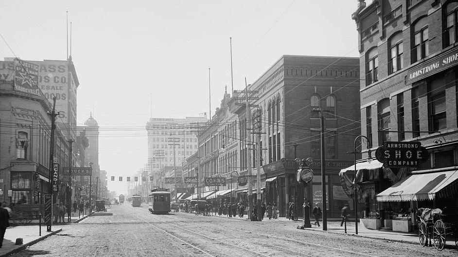
Main Street in Little Rock, Arkansas, sometime between 1900 and 1920. The photo was taken by the Detroit Publishing Co.
Little Rock — La Petite Roche
Little Rock, the capital and largest city of Arkansas, began its development in 1722 when French explorer Jean-Baptiste Bénard de la Harpe co-founded a trading post near the Quapaw Nation’s land.
He named it La Petite Roche, meaning “the little rock” in French, after a rock formation protruding from the Arkansas River that served as a landmark for travelers.
In the early 19th century, Arkansas came under American control, and the name was anglicized to Little Rock. It was declared the capital of the Arkansas Territory in 1819 and was officially incorporated as a city in 1831.
-
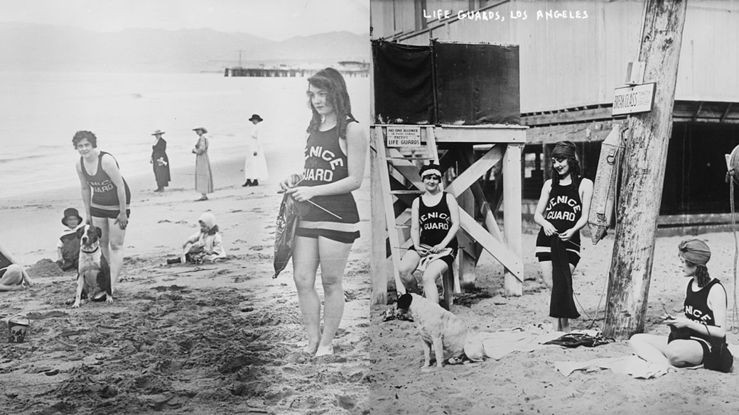
Lifeguards on the beaches of Los Angeles between 1915 and 1920. The photo was taken by the Bain News Service.
Los Angeles — Porciúncula
The area around Los Angeles was first explored in the 16th century, but it was not settled until September 4, 1781. A group of 44 settlers, known as the Los Angeles Pobladores, established a settlement with the lengthy name “El Pueblo de Nuestra Señora la Reina de los Ángeles de Porciúncula.”
The name translates to “The Town of Our Lady, Queen of Angels of Porciúncula.” The Queen of Angels refers to the Virgin Mary, and Porciúncula refers to a small chapel.
By 1820, the population had grown to 650. The following year, Mexico gained independence from New Spain, making the settlement the capital of Alta California. Los Angeles became part of the United States on February 2, 1848. The arrival of the railroad in California and the city’s role as a major oil producer in the early 20th century fueled its rapid growth.
-
← Louisville City Hall around 1906. The photograph is credited to the Detroit Publishing Co.
→ The Island Queen steamboat on the Ohio River between 1890 and 1910.Louisville, Kentucky — Corn Island
Corn Island was discovered in 1773 by a group led by colonizer Thomas Bullitt. Its fertile land was not settled until five years later when a group of soldiers and about sixty civilians arrived during the American Revolutionary War.
The settlers sustained themselves through farming, giving the place its name, Corn Island. In 1780, the government decided to establish a new town near Corn Island. It was named Louisville in honor of King Louis XVI of France.
-
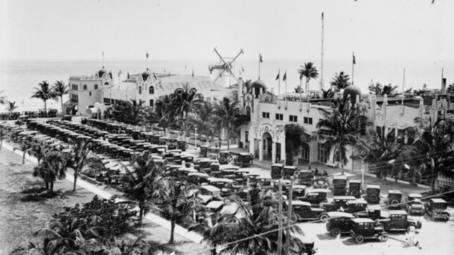
The Miami Beach Casino around 1923. Notice the almost hopelessly packed parking lot.
Miami — Fort Dallas
The history of Miami dates back to the Seminole Wars of the 19th century. In 1836, the U.S. Army took over part of the plantation owned by Richard Fitzpatrick and William English and established Fort Dallas on the site. The fort wasn’t primarily built to combat warring Native Americans but to deter potential enemies from nearby waters.
The fort provided protection not only to soldiers but also to civilians moving into the area surrounding the Miami River. A road to Fort Lauderdale was constructed, as well as a railway to Jacksonville, and on July 28, 1896, Miami officially became a city. At the time, its population was 300, and just 35 years later, it had grown to 110,637.
The city’s name comes from the nearby Miami River, which itself was named after the ancient Mayaimi tribe. The same name was once used for nearby Lake Okeechobee.
-
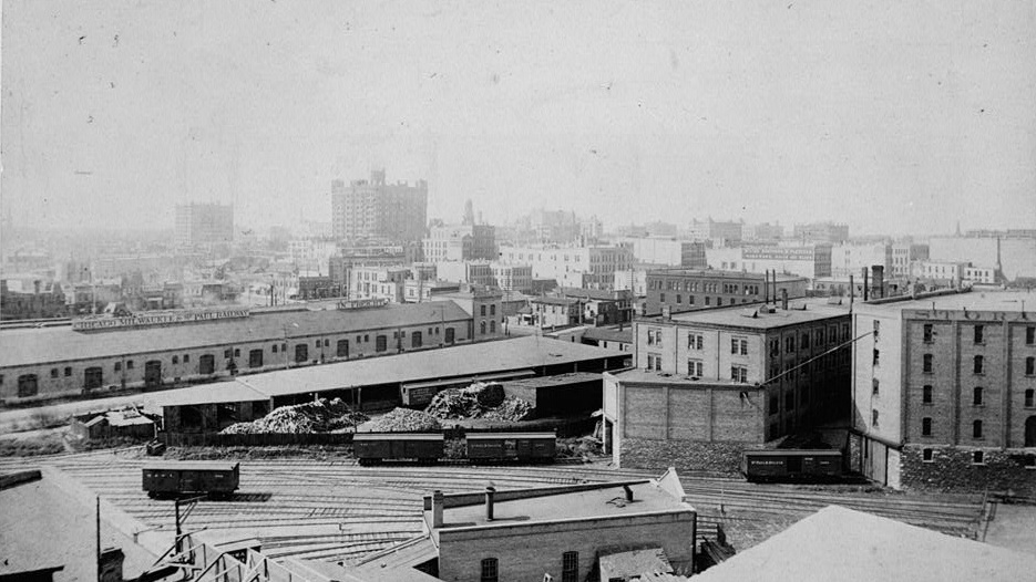
A freight train station in Minneapolis around 1895, photographed by Burt Levy.
Minneapolis — Fort Saint Anthony
The area near the Great Lakes was inhabited by the Dakota tribe as early as the 17th century. Around 1680, French explorers arrived, displaced the indigenous people, and took control of the region, benefiting from the lucrative fur trade.
In the early 19th century, the territory was handed over to the Americans, and in 1819, they built Fort Saint Anthony, later renamed Fort Snelling. The fort primarily provided military protection and security for fur traders. As a result, the population in the area steadily increased.
By 1855, Saint Anthony had a population of 3,000 and was declared a city. Just a year earlier, construction had begun on the west bank of the Mississippi River. Thanks to the efforts of founder John H. Stevens, development was well-organized, and the new city was officially incorporated in 1867 under the name Minneapolis.
Today, with a population of 410,939, Minneapolis is the largest city in Minnesota.
-
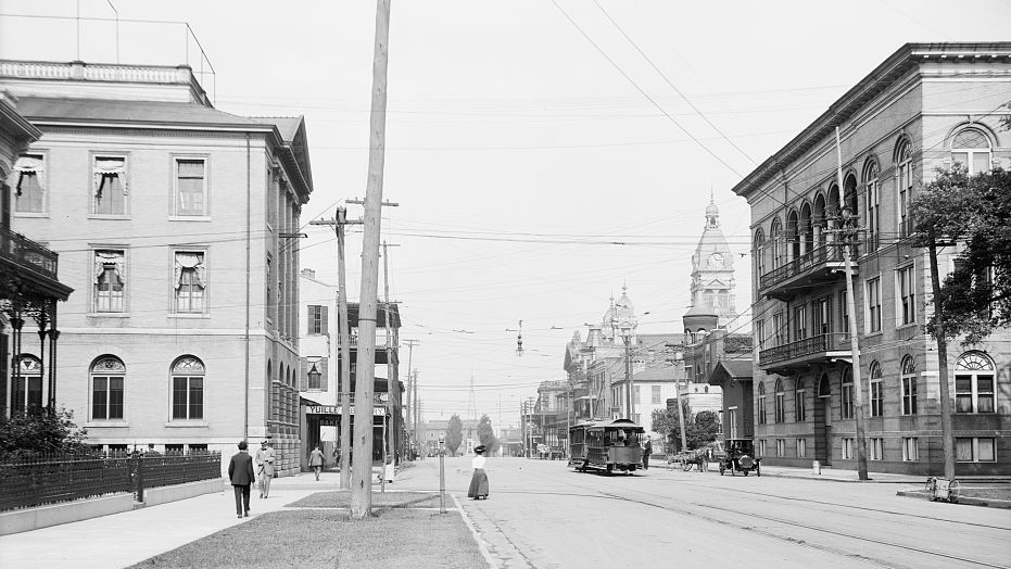
Government Street in Mobile, Alabama, sometime between 1900 and 1915. The photo was published thanks to the Detroit Publishing Co.
Mobile — Fort Louis de la Louisiane
The founding of Mobile was driven by French colonists, who built Fort Louis de la Louisiane along the Mobile River in 1702. The residents eventually shortened the name to La Mobile. The area was under French control, and the fort was established to ensure better oversight of the region.
The fort’s population fluctuated between 178 and 279, depending on trade success and waves of disease affecting Louisiana.
Following a successful battle against the British and their allies, Mobile was transferred to American control in 1813. The town was officially recognized as a city on January 20, 1814. Three years later, boundary changes placed Mobile within the state of Alabama, where it remains today.
-
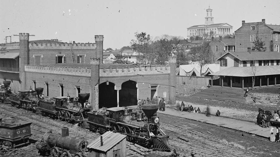
The railway depot in Nashville in 1864, with the Tennessee State Capitol building visible in the background. The photo was taken by George Barnard.
Nashville — Fort Nashborough
Nashville was founded in 1779 by explorers James Robertson and John Donelson within the palisades of Fort Nashborough. The fort protected settlers from wild animals and Native American raids. It contained about 20 wooden structures and was named after American Revolutionary War hero Francis Nash.
The population quickly grew, as Nashville benefited from its strategic location along the Cumberland River. After the port and railway opened, it became an important transportation hub, and in 1806, Nashville was officially granted city status.
At that time, Nashville had around 345 residents, nearly half of whom were African American slaves. Today, Nashville is best known as the heart of country music in the United States.
-
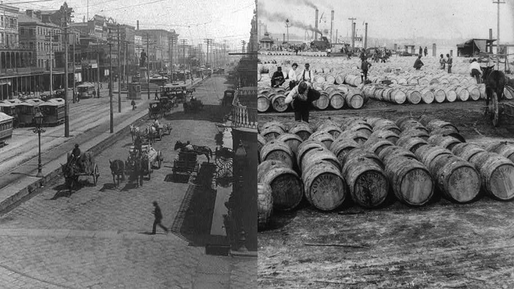
← Canal Street in New Orleans was the world’s widest street when this photo was taken in 1850.
→ Sugarcane was one of Louisiana’s most important agricultural crops. In this 1902 photo, workers are preparing to load the commodity onto a steamboat.New Orleans — La Nouvelle-Orléans
The city of New Orleans was founded on May 7, 1718, by the Mississippi Company, which managed assets in the French colonies of North America. The Louisiana region remained under French control, with a brief interruption, until 1803, which is why the city’s original name was the grand-sounding French “La Nouvelle-Orléans.”
The name was chosen in honor of Philippe II, Duke of Orléans, who was ruling France at the time. The indigenous Chitimacha people originally inhabited Louisiana, and New Orleans gradually developed into one of the centers of the slave trade.
By the early 19th century, enslaved individuals made up about 40-50% of New Orleans’ population. Their numbers grew rapidly, with the city surpassing 100,000 residents before 1840. By 1900, the population of New Orleans had reached 287,104.
-
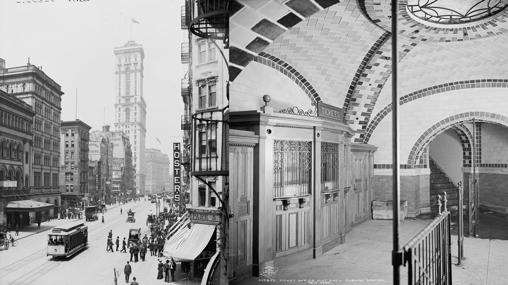
← Broadway and the Times Building at Times Square, New York City, between 1903 and 1910.
→ Entrance to the City Hall subway station around 1904. Both photos are from the Detroit Publishing Company.New York — New Amsterdam
New York was established on the foundations of the Dutch colonial city of New Amsterdam, founded in 1625 near Fort Amsterdam, which protected the fur trade along the Hudson River. At that time, the Dutch governed the region, and New Amsterdam became the capital of the entire province that same year.
In 1664 (some sources say on September 8), the city was renamed New York in honor of the Duke of York, who would later become James II of England.
-
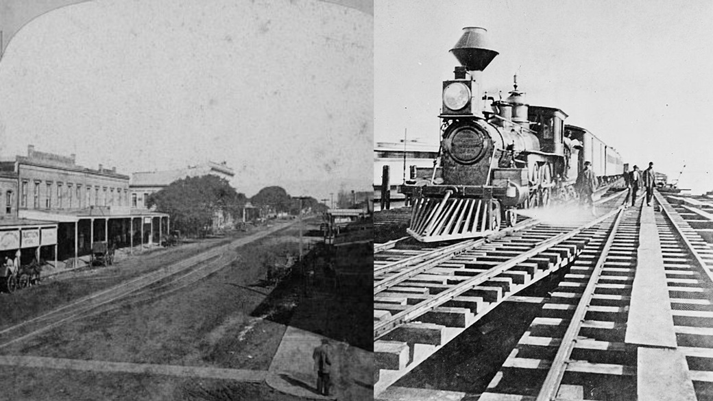
← Oakland station around 1870, photographed by Thomas Houseworth from San Francisco.
→ On November 8, 1869, the first transcontinental train arrived in Oakland.Oakland — Encinal
The first mentions of Oakland date back to 1772 when the area, along with the rest of California, was claimed by Spain. The region was covered by a dense oak forest, which led to its name, Encinal (Spanish for “oak grove”).
Significant development began in 1851, thanks to three developers—Horace Carpentier, Edson Adams, and Andrew Moon—who started construction. On May 4, 1852, they successfully registered the city of Oakland. They didn’t overthink the name: by that time, California was already under American control, so they simply translated the original Spanish name into English.
The population grew rapidly, particularly during the 1860s and 1870s, largely due to the railroads, as Oakland became one of the key transportation hubs of the western United States.
-
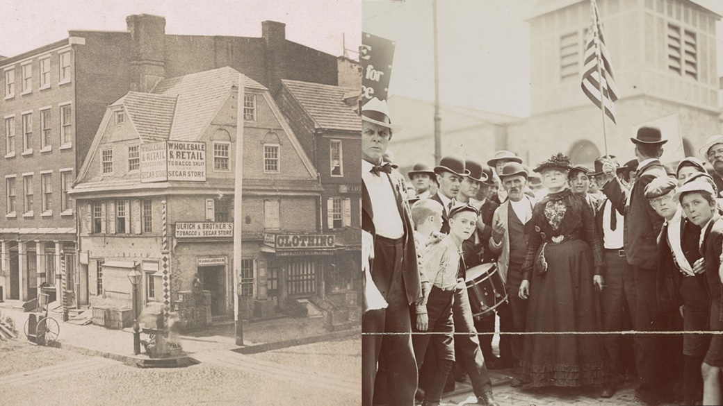
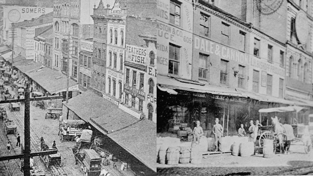
← Old London Café at the intersection of Market Street and Front Street in Philadelphia, 1854.
→ Union activist Mary Harris Jones led a textile workers’ strike in 1903 to highlight the dire state of the American economy.Philadelphia — Shackamaxon
The land between the Delaware and Schuylkill Rivers was originally inhabited by the Lenape tribe. Within what is now Philadelphia, the important village of Shackamaxon stood, where tribal leaders were chosen under a towering elm tree.
On October 27, 1682, British politician and merchant William Penn founded Philadelphia, the capital of the proprietary English colony of Pennsylvania. Penn received the land from Charles II of England as payment for a debt owed to Penn’s father. According to legend, he signed a treaty with the Lenape under the sacred tree. The city’s name, Philadelphia, derives from the Greek words “philos” (love) and “adelphos” (brother).
By the early 18th century, Philadelphia was an important commercial and transportation hub. In 1683, it had just a few hundred residents, but by 1701, the population had grown to over 2,500. The city surpassed the one-million mark in 1890.
-
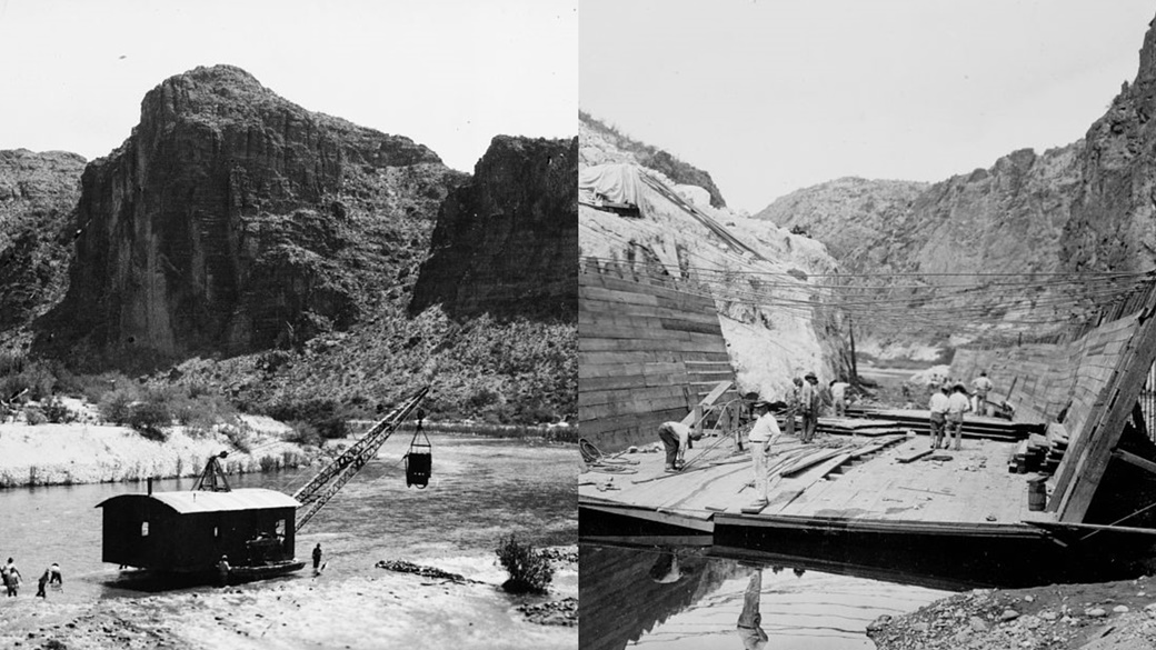
In 1923, workers were building the Mormon Flat Dam on the Salt River, east of Phoenix. The dam, 223 ft high, was completed in 1925. The photographer is unknown.
Phoenix — Stonewall
The history of Phoenix is closely linked to Jack Swilling, a veteran of the American Civil War. In 1867, while traveling through the Salt River Valley, he saw the potential for farming. That same year, he founded a small settlement 4 mi east of what is now downtown Phoenix.
The name Phoenix was proposed by Lord Darrell Duppa, one of the original settlers, who envisioned the city as rising from the ashes of ancient civilizations that had long inhabited the area of Arizona. Jack Swilling opposed the name, preferring Stonewall, after Civil War general Thomas Jonathan “Stonewall” Jackson. Other settlers suggested names like Salina, after the Salt River, or Pumpkinville, referencing the wild pumpkins growing throughout the area.
-
Liberty Avenue in Pittsburgh, 1899.
Pittsburgh — Pittsborough
The village of Pittsborough was established in 1758, shortly after the construction of Fort Pitt. The construction of the fort was overseen by British army officer John Forbes, who was also responsible for naming the settlement.
He chose the name Pittsborough in honor of William Pitt, the 1st Earl of Chatham, who led Great Britain during the Seven Years’ War. The population of Pittsborough continued to grow despite frequent wars, uprisings, and the American Revolution.
On March 18, 1816, the settlement was officially designated as a city, and its name was changed to Pittsburgh. Some sources suggest that the name change was due to a typo on official documents, but the shorter version, Pittsburgh, remained permanent.
-
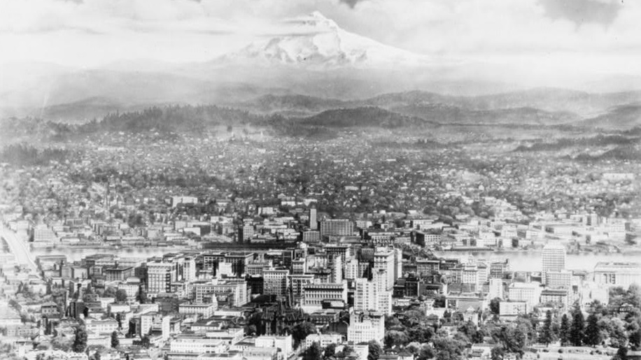
The photo, taken by an unknown photographer, shows Portland, Oregon, in 1927. Mount Hood can be seen in the background.
Portland — Stumptown / The Clearing
After 1830, crowds of settlers poured into the Willamette Valley, usually traveling along the Oregon Trail from distant Kansas. About a decade later, wooden cabins of a new settlement began to emerge at the mouth of the Willamette River thanks to their efforts.
The settlers referred to the place as Stumptown or The Clearing, names that referenced the abundance of freshly cut trees in the area. In 1843, settler William Overton recognized the potential of the location and sought to establish a village there. However, he lacked the funds to purchase the land, so he partnered with pioneer and politician Asa Lovejoy.
In 1845, Overton sold his remaining share to Francis Pettygrove, and on February 8, 1851, the new town was officially registered. Both founders wanted to rename The Clearing after their hometowns: Lovejoy favored Boston, while Pettygrove suggested Portland in Maine. The decision was made through three coin tosses, requiring two correct calls for a win. This is how two cities in the U.S. came to be named Portland.
-
The capitol building in Raleigh, North Carolina, around 1909. The photograph was attributed to the Haines Photo Co.
Raleigh — Bloomsbury
Raleigh is a city in North Carolina with approximately 450,000 residents. Its history dates back to 1770–1771, when the North Carolina General Assembly decided to establish a new county by splitting parts of Cumberland, Orange, and Johnston counties. The first county seat was Bloomsbury.
In 1788, a decision was made to move the city further inland for better protection against coastal attacks. This led to the founding of Raleigh in 1792, named after Sir Walter Raleigh, the founder of the nearby Roanoke Colony.
-
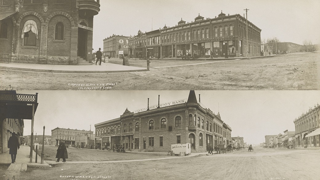
↑ The corner of St. Joe Street and 7th Street in Rapid City around 1909.
↓ The corner of Main Street and 6th Street in the same city and period. Both photos are attributed to Edward McNamara.Rapid City — Hay Camp
The 1874 Black Hills Expedition by the U.S. Army discovered rich gold deposits in the South Dakota region, sparking a gold rush and rapid population growth. In 1876, a group of miners founded the settlement of Hay Camp, promoting it as the gateway to the Black Hills. The town was later named Rapid City after the nearby Rapid Creek.
The founders took city-building seriously. They carefully divided the land, established a business district, and began selling supplies to miners. The city saw significant growth at the end of the 19th century with the arrival of the railroad from the south and east.
-
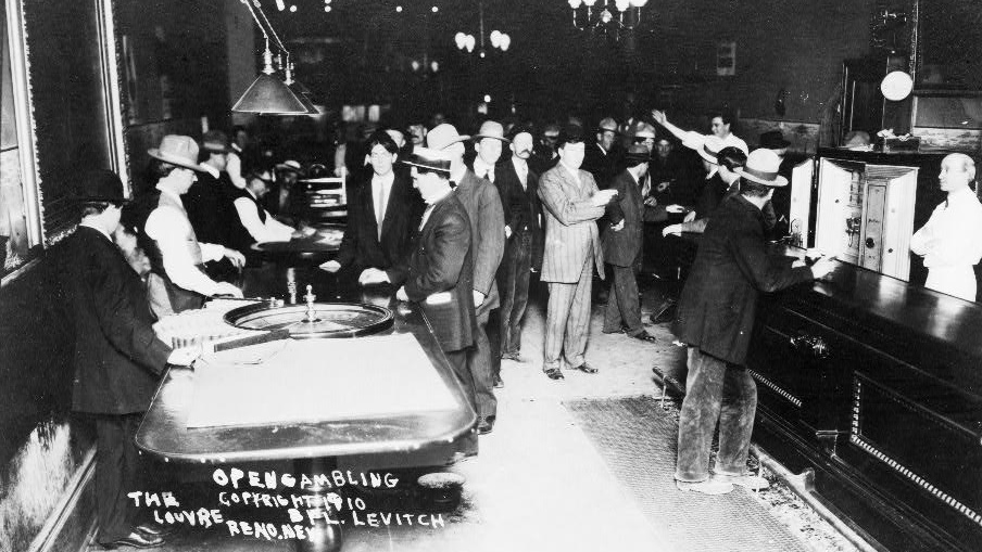
Casinos thrived in Nevada as early as 1910, as evidenced by this photo of the Louvre establishment. Note the absence of women in the picture.
Reno — Lake’s Crossing
Reno is a city in the state of Nevada, with an estimated population of 241,000 in 2015.
In 1850, gold was discovered near Virginia City, creating a small community of miners. The real boom began nine years later with the discovery of silver deposits under Mount Davidson’s eastern slope.
The area quickly developed, with mills, hotels, and dining establishments springing up. Developer Myron C. Lake purchased the land and expanded it as Lake’s Crossing. By January 1863, the Central Pacific Railroad was set to cross through the area. Recognizing the opportunity, Lake donated land to the railroad company in exchange for a promise to build a station.
Railroad companies often chose the names of new towns, and in this case, the station was built as promised. The city of Reno was officially founded on May 9, 1868, and named after Civil War veteran Jesse L. Reno, who fought for the Union.
-
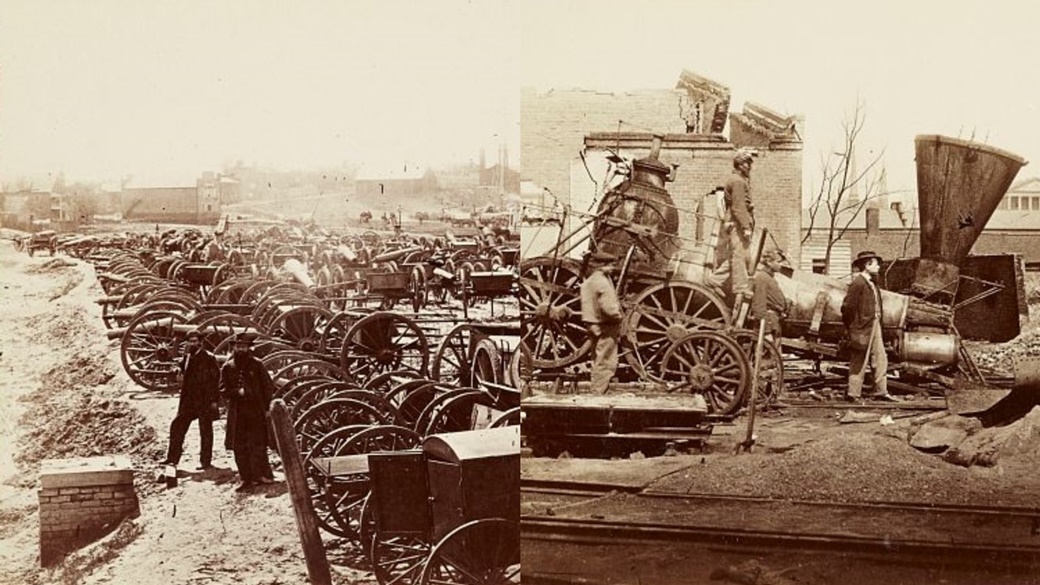
← Union artillery prepares to move north. The photo was taken in 1865 by the Taylor & Huntington studio.
→ Richmond’s train depot in 1865, where more than 700 buildings were damaged during an attack by Confederate forces.Richmond — Fort Charles
The first English-speaking settlers arrived in what is now Virginia in April 1607. However, frequent conflicts with the native Powhatan tribe led to the construction of Fort Charles and Fort Henry in 1645.
Peace was established in the mid-17th century through a treaty. More significant settlement began in 1737 when plantation owner William Byrd II commissioned English builder William Mayo to design a plan for the emerging city. Byrd named it Richmond after a district in London, as the view from the James River reminded him of the sight of the Thames from Richmond Hill in England.
Development progressed rapidly, and the first residents moved to Richmond by April of the same year. The city was officially recognized in 1742.
-
M Street in Sacramento during the summer of 1934, photographer unknown.
Sacramento — New Helvetia
In August 1839, Swiss settler John Sutter arrived in Upper California, which at the time was part of Mexico. Along with other European immigrants, he founded a settlement named after his homeland—New Helvetia, or New Switzerland. Shortly thereafter, the area experienced a gold rush, and John Sutter’s son decided to establish a new city located about 1 mi south of New Helvetia.
The city was named after the Sacramento River. While its population in 1850 was fewer than seven thousand residents, estimates show it had grown to 526,384 by 2023.
-
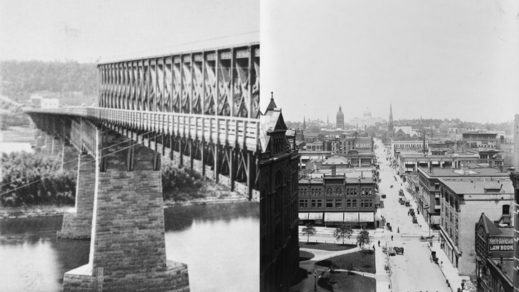
← Wabasha Street Bridge — the first bridge across the Mississippi River in St. Paul. This photo was taken in 1867.
→ Cedar Street in St. Paul around 1908, with the state capitol building visible in the background.Saint Paul — Pig’s Eye
The southern Minnesota region was inhabited by the Sioux tribe from the early 17th century until 1837. In 1805, General Zebulon Pike negotiated the purchase of 156 sqmi of land from them.
The land was divided by the Mississippi River, and the U.S. Army constructed the strategically positioned Fort Snelling there in 1819. Explorers, fur traders, and missionaries sought protection at the fort from Native American raids.
During the 1840s, illegal whiskey trading flourished within the fort, prompting the army to expel settlers from Fort Snelling. Pierre “Pig’s Eye” Parrant, a former fur trader, was a key figure in the alcohol trade. After his expulsion, he founded a new settlement around his tavern, Pig’s Eye.
Over time, this settlement became a vital trading hub and a favored stop for settlers heading west. Between 1850 and 1900, the population grew from 1,112 to 163,065. In 1849, Saint Paul became the capital of Minnesota, though it was officially designated a city on March 4, 1854.
Of note is the strong Czech and Slovak immigrant community, which established organizations such as the Slavic Literary Society (1868–1879), the Sokol physical fitness association (1882), and the Czech-Slovak Support Society.
-
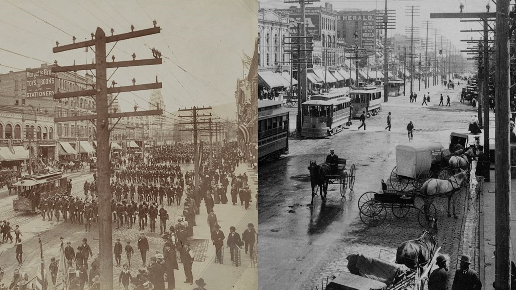
← April 24, 1898, Salt Lake City: The 24th Infantry leaves the city, heading to Tennessee.
→ Main Street in Salt Lake City around 1904, as photographed by Underwood & Underwood Studio.Salt Lake City — Great Salt Lake City
Salt Lake City was founded by Mormon pioneers seeking a remote and secure place for spiritual growth. They arrived in the valley on July 24, 1847, and just four days later, they designated the site for the construction of the Salt Lake Temple.
The temple, completed after 40 years, became a symbol of the city and the largest Mormon temple in the world. Meanwhile, the settlers built the city itself, which was formally registered as Great Salt Lake City on January 6, 1851.
Initially, the city remained isolated, with the Mormon community maintaining strong cohesion. It began opening up to the world after the completion of the first transcontinental railroad in 1869. Salt Lake City gained international recognition in 2002 when it hosted the Winter Olympics.
-
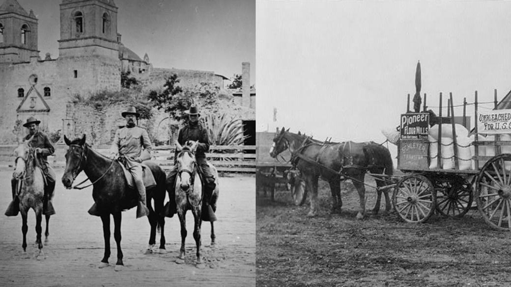
← Theodore Roosevelt (center) poses on horseback during the Spanish-American War, San Antonio, 1898.
→ A cart delivers supplies of unbleached flour to the Fort Sam Houston military base in San Antonio, taken between 1911 and 1912.San Antonio — Yanaguana
San Antonio, located in Texas, was named on June 13, 1691, when a group of Spanish Catholics arrived in the area. The day marked the feast of St. Anthony of Padua, and the place was named in his honor. Spanish settlement began in 1718, and the town was officially established as a city on June 5, 1837.
The valley along the San Antonio River provided favorable living conditions, and people had lived there long before the Spanish arrived. Early mentions of the settlement reference the Payaya Native American tribe, who called the area rich in natural springs “Yanaguana,” meaning “refreshing waters.”
San Antonio is home to the famous Alamo fortress, built in 1744. In the spring of 1836, the Battle of the Alamo occurred there, leading to Texas’ independence from Mexico and its formation as a republic.
-
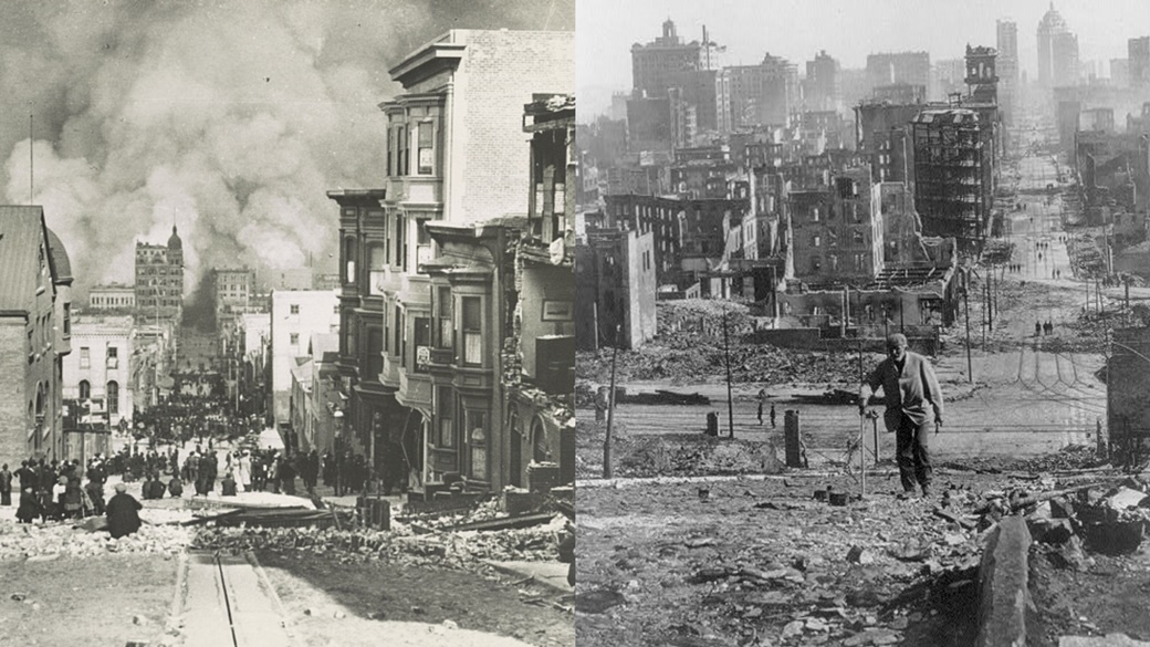
← On April 18, 1906, at 5:12 a.m., a devastating earthquake struck San Francisco, killing more than 3,000 people and destroying 80% of the city. A total of 25,000 buildings across 490 city blocks were lost, with 90% of the damage caused by subsequent fires. The photo shows Sacramento Street, taken by Arnold Genthe.
→ The second photograph, showing Kearney Street near Telegraph Hill, was taken by an unknown photographer after the earthquake.San Francisco — Yerba Buena
Yerba Buena was the name of the Spanish settlement founded around 1776 on the site of present-day San Francisco. The name references the plant Clinopodium douglasii, which was abundant in the area.
The city was renamed San Francisco on January 30, 1847, by order of U.S. Army Lieutenant Washington Allon Bartlett, shortly after American forces captured the territory. Bartlett later became the city’s first mayor.
-
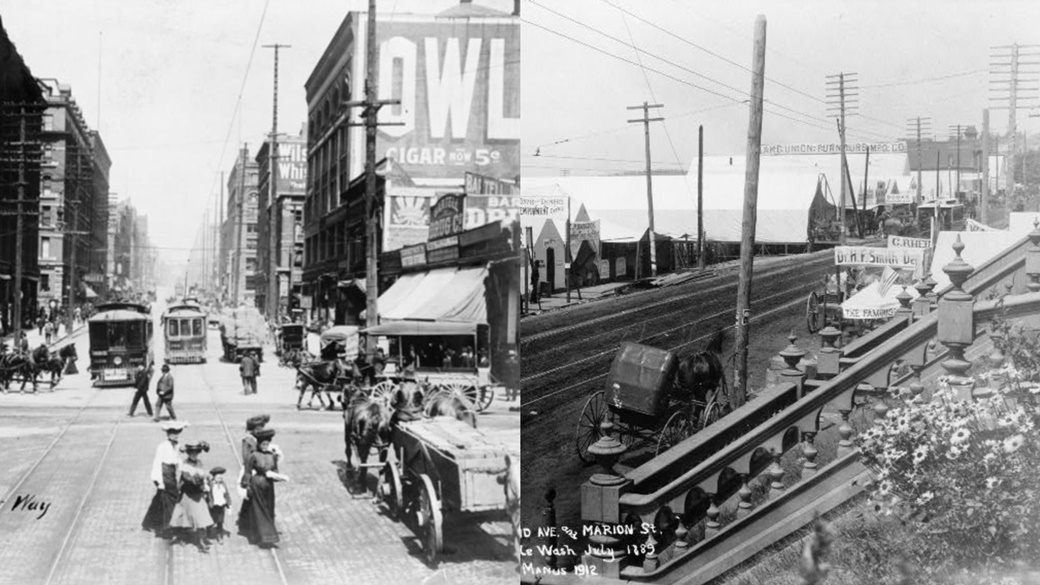
← The corner of Second Avenue and Yesler Way in Seattle in 1904.
→ Stores, doctors, and other businesses were located on Second Avenue and Marion Street in Seattle as early as July 1889.Seattle — Dewamps / Duwamps
Seattle is a port city on the west coast of the United States, with a population of 755,078 in 2023. The history of Seattle began in September 1851 when a group led by Luther Collins settled in the Duwamish River estuary and established a farming settlement.
Just two months later, a group of American pioneers known as the Denny Party decided to spend the winter nearby. They first settled on Alki Point, in what is now the westernmost part of Seattle, naming the area Duwamps after the Duwamish tribe.
In April, they relocated to the area that is now the city center, and the name was soon changed to Seattle, an Anglicized version of Si’ahl, the name of a Duwamish and Suquamish tribal chief.
-
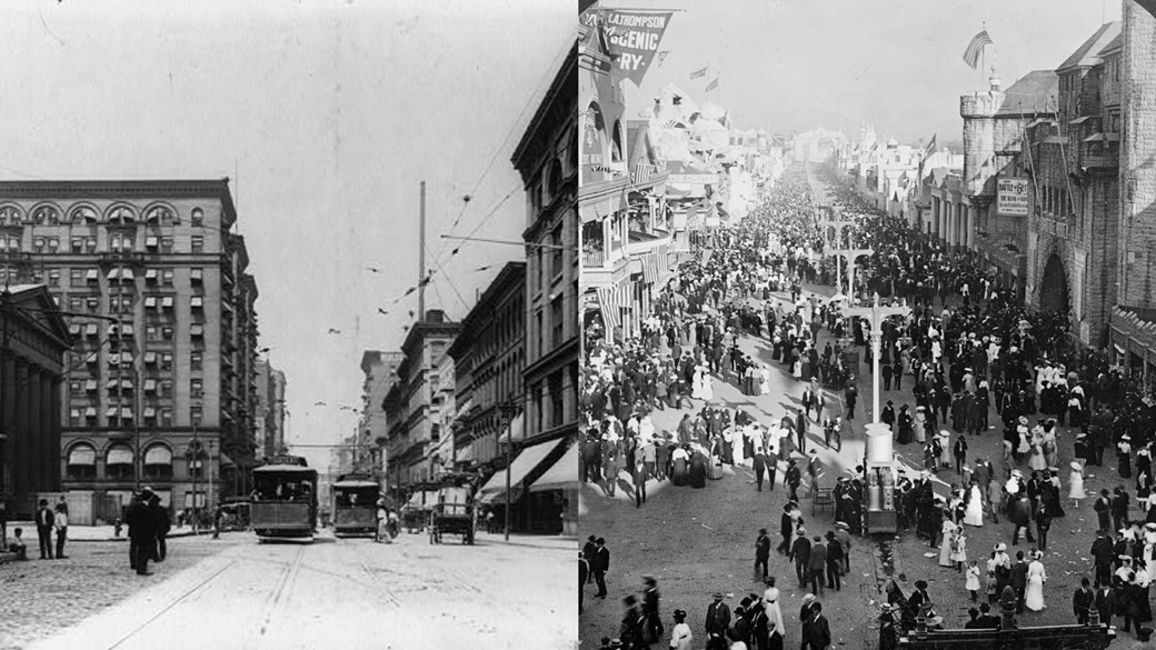
← 4th Street in St. Louis around 1903. Today, trams no longer run there.
→ The 1904 St. Louis World’s Fair popularized the ice cream cone, Dr. Pepper soda, and peanut butter.St. Louis — Cahokia
St. Louis was founded in 1764 at a location where, between 600 and 1400 AD, the largest Native American city, Cahokia, once stood. The city’s founders, French fur traders Pierre Laclède and Auguste Chouteau, named it after Louis IX of France.
Between 1763 and 1800, the city was under Spanish rule, before being returned to France and later sold to the United States as part of the Louisiana Purchase in 1803. The purchase included areas that would become Arkansas, Missouri, Iowa, Oklahoma, Kansas, Nebraska, and parts of Minnesota, North Dakota, South Dakota, New Mexico, Texas, Montana, Wyoming, Colorado, and Louisiana.
The U.S. paid 50 million francs in cash and forgave an additional 18 million francs in debt, totaling about one billion dollars in today’s value.
-
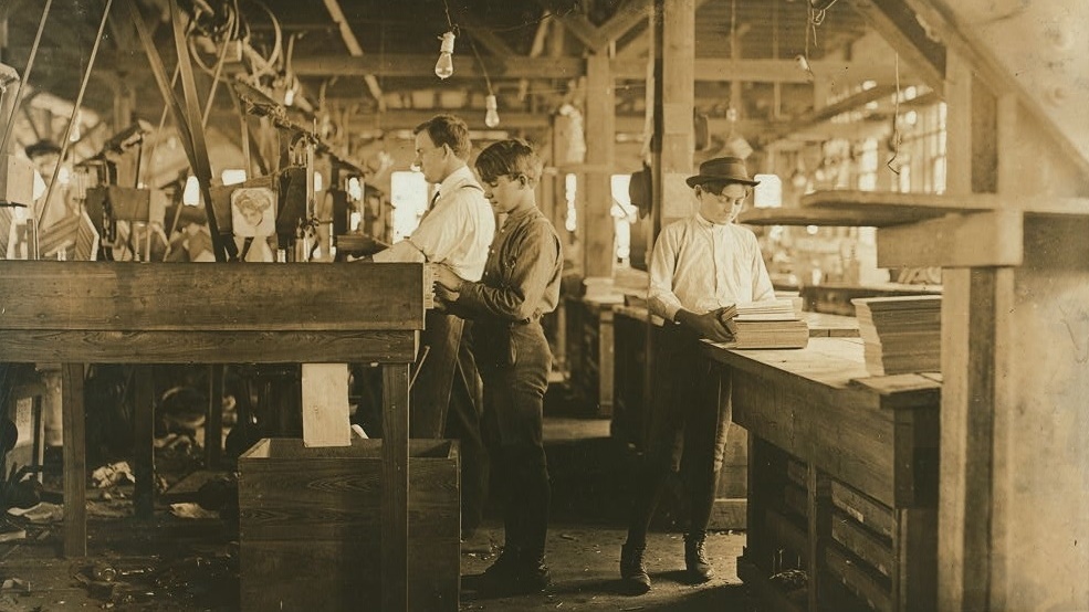
A photograph of workers in a cigar-making factory, including boys and girls who had to pay for work permits. Taken by Lewis Wickes Hine on January 28, 1909, in Tampa, Florida.
Tampa — Fort Brooke
The area at the mouth of the Hillsborough River was first settled between 1823 and 1824 when the U.S. Army established Fort Brooke. The U.S. had acquired Florida from Spain only four years earlier, so building the necessary infrastructure was a logical step.
The first civilian settlers lived near the fort, as it provided protection from the indigenous Seminole tribe. In 1849, they established a small and relatively insignificant village named Tampa. By 1850, it had 974 residents, but the population dropped to 720 by 1880. Then, things changed.
Railroads arrived in Tampa, significant phosphate deposits were discovered, and the cigar trade flourished. Over the next 40 years, the population surged from 720 to 101,161 by 1930.
-
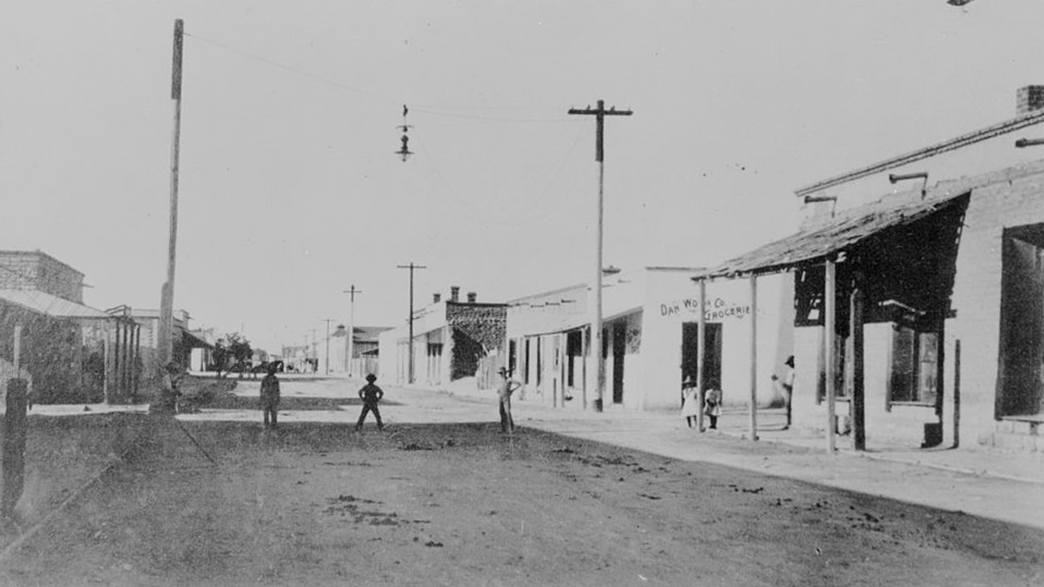
The intersection of West Kennedy Street and West Seventeenth Street in Tucson around 1890.
Tucson — San Augustín del Tucson
Tucson’s official history dates back to 1775 when Spanish soldiers established the Presidio San Augustín del Tucson.
In 1821, Mexico gained independence from Spain, and Tucson became part of the Mexican state of Occidente (now Sonora). The U.S. purchased the city in 1853 as part of its plans to build a transcontinental railroad. As was common during that time, the railroad significantly boosted the city’s growth. Between 1850 and 1880, its population increased from 400 to 7,007. By 2023, Tucson had approximately 547,000 residents.
-
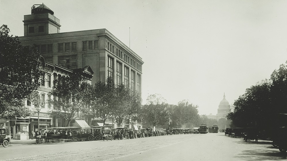
A photograph of Pennsylvania Avenue in Washington, likely taken in 1921. The taller building on the left is the Ford Motor Company Building, which today houses the Canadian Embassy.
Washington D.C. — Alexandria / Georgetown
The decision to establish the new capital city near the Potomac River was made on July 16, 1790. According to the U.S. Constitution, the federal district is independent and does not belong to any U.S. state. The land for Washington D.C. was donated by the states of Maryland and Virginia, and included existing settlements such as Alexandria and Georgetown.
Washington officially became the U.S. capital in 1791 and was named after the first president, George Washington.
During the War of 1812, British forces burned Washington D.C. from August 24 to 25, 1814, causing severe damage to key buildings such as the U.S. Capitol, the White House, and the Treasury Department. Most of the damaged structures were quickly repaired, though the Capitol was not completed until 1868.
-
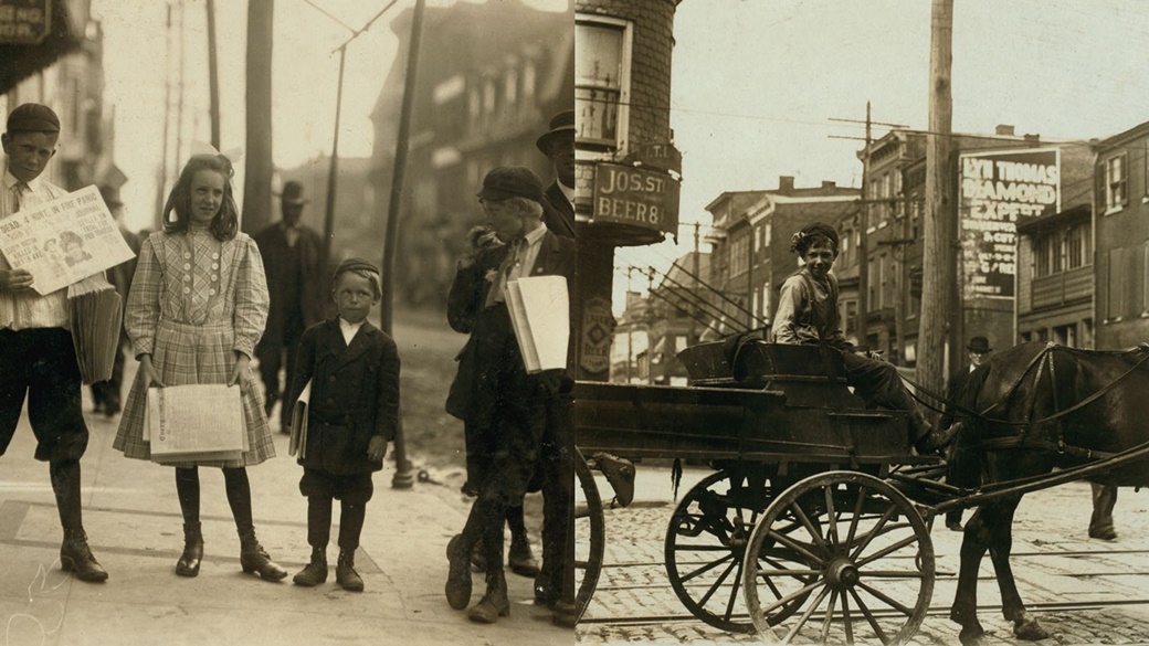
← Children selling newspapers on the streets of Wilmington.
→ 14-year-old Robert Reynolds earns extra money by selling newspapers, making 50 cents a week. Both photographs were taken by Lewis Wickes Hine in May 1910.Wilmington — Fort Christina
The area around Wilmington in Delaware was the first to be settled by Swedes in America. In March 1638, settlers led by Peter Minuit arrived and built Fort Christina on land purchased from the Native Americans.
The fort served as the base for the small New Sweden colony. In the 17th century, the English began taking control of the Delaware region. In 1731, landowner Thomas Willing renamed the growing settlement Willingtown. However, the name did not last long; around 1739, King George II of England ordered it to be renamed Wilmington.

 10 Best Photo Places in the USA





Contribute with Your Question or Personal Experience